Walking the John o' Groats Trail
Cicerone Press (Verlag)
978-1-78631-057-6 (ISBN)
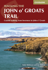
A guidebook to walking the John o' Groats Trail between Inverness and John o' Groats at the northeastern tip of mainland Britain. Covering 233km (145 miles), this Scottish coastal trail takes 2 weeks to hike and is suitable for experienced walkers.
The route is described from south to north in 14 stages, each between 10 and 25km (6–16 miles) in length. Summary notes are also included for southbound walkers. An alternative start from Drumnadrochit is detailed, allowing walkers from the Great Glen to bypass Inverness.
Mapping is included for each stage
GPX files available to download
Detailed information on facilities, public transport and accommodation on route
Advice on planning and preparation
Andy Robinson is the author of The End to End Trail - Land's End to John o' Groats on Foot, and has worked together with Jay Wilson to create a guide to the John o' Groats Trail. Jay Wilson is the founding chair of the Friends of the John o' Groats Trail; he had the principal guiding role in the creation of the Trail.
Overview map
Key to stage overview maps
Key to stage maps
Route summary table
Introduction
The terrain in more detail
The hazards of the Trail
Transport links
Access considerations
Accommodation
Equipment
Wildlife
Climate and day length
Geology
Using this guide
The John o' Groats Trail
Stage 1 Inverness to Culbokie
Stage 2 Culbokie to Alness
Stage 3 Alness to Tain
Stage 4 Tain to Dornoch
Stage 5 Dornoch to Golspie
Stage 6 Golspie to Brora
Stage 7 Brora to Helmsdale
Stage 8 Helmsdale to Berriedale
Stage 9 Berriedale to Dunbeath
Stage 10 Dunbeath to Lybster
Stage 11 Lybster to Whaligoe
Stage 12 Whaligoe to Wick
Stage 13 Wick to Keiss
Stage 14 Keiss to John o' Groats
Bonus tracks
Stage A1 Drumnadrochit to Beauly
Stage A2 Beauly to Dingwall
Stage A3 Dingwall to Alness
Appendix A Useful contacts
| Erscheinungsdatum | 14.02.2023 |
|---|---|
| Reihe/Serie | Cicerone guidebooks |
| Zusatzinfo | 18 overview maps, 64 route maps and over 40 colour photos |
| Verlagsort | Kendal |
| Sprache | englisch |
| Maße | 116 x 172 mm |
| Themenwelt | Sachbuch/Ratgeber ► Sport |
| Reiseführer ► Europa ► Großbritannien | |
| Reisen ► Sport- / Aktivreisen ► Europa | |
| ISBN-10 | 1-78631-057-0 / 1786310570 |
| ISBN-13 | 978-1-78631-057-6 / 9781786310576 |
| Zustand | Neuware |
| Haben Sie eine Frage zum Produkt? |
aus dem Bereich