Trucker's Atlas Britain
Seiten
2019
|
10th edition
Automobile Association (Verlag)
978-0-7495-8199-2 (ISBN)
Automobile Association (Verlag)
978-0-7495-8199-2 (ISBN)
Zu diesem Artikel existiert eine Nachauflage
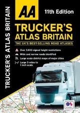
The AA Truckers Atlas is perfect for professional drivers to easily use whilst on the road and when planning routes, this large format A3 road atlas has a clear 3 miles to 1 inch scale.
Fully updated for 2020, the atlas includes truck and freight ferry routes and port plans, route planner map, quick reference distance chart and an explanatory list of restricted motorway junctions. Additionally there is a 12-page section of London street mapping with height, width and weight restrictions clearly marked, as well as large scale district maps of London, Birmingham, Glasgow, Manchester and Tyne & Wear.
Fully updated for 2020, the atlas includes truck and freight ferry routes and port plans, route planner map, quick reference distance chart and an explanatory list of restricted motorway junctions. Additionally there is a 12-page section of London street mapping with height, width and weight restrictions clearly marked, as well as large scale district maps of London, Birmingham, Glasgow, Manchester and Tyne & Wear.
AA Publishing is the UK's largest travel publisher, with an extensive range of inspiring travel guides, dependable driving books, and trusted maps and atlases.
| Erscheinungsdatum | 02.03.2020 |
|---|---|
| Verlagsort | Basingstoke |
| Sprache | englisch |
| Maße | 285 x 402 mm |
| Themenwelt | Reisen ► Karten / Stadtpläne / Atlanten ► Europa |
| ISBN-10 | 0-7495-8199-9 / 0749581999 |
| ISBN-13 | 978-0-7495-8199-2 / 9780749581992 |
| Zustand | Neuware |
| Haben Sie eine Frage zum Produkt? |
Mehr entdecken
aus dem Bereich
aus dem Bereich
Buch | Spiralbindung (2024)
Freytag-Berndt und ARTARIA (Verlag)
29,90 €


