The Mountains of Romania
Cicerone Press (Verlag)
978-1-85284-948-1 (ISBN)
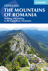
A guidebook to a selection of 37 walks and short treks (of 2–6 days) in the mountains of Romania. Routes are graded by difficulty: popular routes have a good network of mountain huts, whereas more remote backpacking routes require complete self-sufficiency.
Day walks range from 11 to 24km and can be enjoyed in 5–8 hours. Treks range from 13 to 98km. The routes cover the mountains of Maramures, the Eastern Carpathians, the mountains around Brasov, the Fagaras Mountains, the region from the Olt to the Jiu, and the Retezat, Banat and Apuseni Mountains. Also included is an ascent of Moldoveanu, Romania’s highest peak.
Clear route description illustrated with 1:100,000 mapping
GPX files available to download
Notes on access, accommodation and water sources for each day’s walking
Accommodation listings for each mountain area
Advice on planning and preparation, including kitlist, local transport and safety
Janneke Klop has been exploring Romania since 2005, having previously been an English teacher. She writes about her Romanian adventures at www.roamaniac.com and also offers guided tours. She lives in Ghent, Belgium and is an active member of the Klim- en Bergsportfederatie (Climbing and Mountaineering Belgium) and Grote Routepaden (Grandes Randonnées).
Map key
Overview map
Author preface
Introduction
Geography
Vegetation and wildlife
History
Language
Culture
Climate
When to go
What to take
Getting there
Local transport
Accommodation
Food and drink
Health and safety
Money
Staying in touch
National parks
Rules and regulations
Maps
Waymarking
Water, food and other supplies
Using this guide
The Mountains of Maramureş
The Rodna Mountains
Route 1 Șetref Pass to Rotunda Pass
The Gut&##xe2;i and Ţibleş Mountains
Route 2 Breb-Creasta Cocoşului-Neteda Pass
Route 3 Groşii Ţibleşului to Arcer, Ţibleş and Bran Peaks
The Munţii Maramureşului
Route 4 Repedea to Prislop Pass
The Eastern Carpathians
The Land of Dorna
Route 5 The Suhard
Route 6 The Rarău-Giumalău
Route 7 The Călimani
The Ceahlău
Route 8 Izvorul Muntelui to Durau
The Hăşmaş Massif and Lacu Roşu
Route 9 Bălan to Lacu Roşu
The mountains around Braşov
The Postăvaru Massif
Route 10 Braşov to R&##xe2;snov
The Piatra Mare Massif
Route 11 D&##xe2;mbu Morii-Piatra Mare Peak via Șapte Scări Gorge
Route 12 Timişu de Sus-Cabana Piatra Mare via Tamina Gorge
The Baiului and Grohotiş
Route 13 A north-south traverse of the Baiului
Route 14 Across the Baiului and Grohotiş
The Ciucaş Massif
Route 15 Cheia to Bratocea Pass
The Bucegi Mountains
Route 16 Poiana Braşov to Omu Peak
Route 17 Into the Bucegi from the Prahova Valley
The Piatra Craiului Mountains
Route 18 The Northern Ridge
Route 19 The Southern Ridge
The Făgăraş Mountains
The Iezer-Păpuşa Massif
Route 20 The Iezer-Păpuşa Circuit
Route 21 From the Iezer-Păpuşa to the Făgăraş
The Făgăraş Chain
Route 22 Traversing the Făgăraş from east to west
From the Olt to the Jiu
The Cindrel and the Par&##xe2;ng
Route 23 From Păltiniş to Stațiunea Par&##xe2;ng
The Cozia
Route 24 The Cozia Circuit
The Buila-V&##xe2;nturariţa
Route 25 Cheia Village-Buila-V&##xe2;nturariţa ridge-Băile Olăneşti
The Retezat Mountains
The Retezat
Route 26 C&##xe2;rnic to Cabana Gura Zlata via Bucura Lake
Route 27 Poiana Pelegii to C&##xe2;rnic via Bucura Lake
The V&##xe2;lcan Massif
Route 28 From the V&##xe2;lcan to the Retezat
The Ţarcu, Godeanu and Retezatul Mic
Route 29 Jigora Saddle to Cabana Buta
The Mountains of Banat
The Domogled-Valea Cernei national park
Route 30 Băile Herculane to Domogled Peak and back
Route 31 Băile Herculane to St&##xe2;nca lui Sisi and back
The Semenic
Route 32 The gorges of the Semenic
The Apuseni Mountains
The Trascău and Muntele Mare
Route 33 The Gorges of the Trascău
Route 34 Poşaga de Jos-Scăriţa Belioara-Runc
Route 35 Runc-Scăriţa Belioara-Lunca Largă-Runc
The Padiş Region
Route 36 Statiunea V&##xe2;rtop-Cetăţile Ponorului-Padiş-Pietroasa
Route 37 G&##xe2;rda de Sus-Scărişoara ice cave-Padiş-Cabana Varasoaia-St&##xe2;na de Vale
Appendix A Route summary table
Appendix B Accommodation
Appendix C Useful contacts
Appendix D Language notes and glossary
| Erscheinungsdatum | 18.02.2020 |
|---|---|
| Reihe/Serie | Cicerone guidebooks |
| Zusatzinfo | 120 maps and over 90 colour photos |
| Verlagsort | Kendal |
| Sprache | englisch |
| Maße | 116 x 172 mm |
| Gewicht | 450 g |
| Themenwelt | Sachbuch/Ratgeber ► Sport |
| Reiseführer ► Europa ► Rumänien | |
| Reisen ► Sport- / Aktivreisen ► Europa | |
| ISBN-10 | 1-85284-948-7 / 1852849487 |
| ISBN-13 | 978-1-85284-948-1 / 9781852849481 |
| Zustand | Neuware |
| Informationen gemäß Produktsicherheitsverordnung (GPSR) | |
| Haben Sie eine Frage zum Produkt? |
aus dem Bereich