


Road Map Normandy
2019
Automobile Association (Verlag)
978-0-7495-8209-8 (ISBN)
Automobile Association (Verlag)
978-0-7495-8209-8 (ISBN)
- Titel ist leider vergriffen;
keine Neuauflage - Artikel merken
Zu diesem Artikel existiert eine Nachauflage
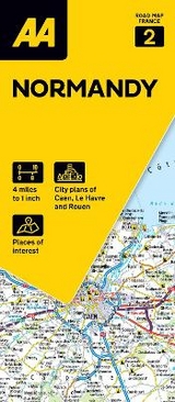
Produced in association with IGN, the slimline, durable map has been fully updated, combining clear design and an easy-to-read scale with more road details to ensure that you never lose your way.
This series of maps includes city and town plans as well as an easy-to-read place name index. The maps also include information on toll points, service areas, road numbers, motorways, dual carriageways and local roads. National Parks, ski resorts, visitor attractions and towns of interest are also highlighted.
This series of maps includes city and town plans as well as an easy-to-read place name index. The maps also include information on toll points, service areas, road numbers, motorways, dual carriageways and local roads. National Parks, ski resorts, visitor attractions and towns of interest are also highlighted.
Road Map Normandy is produced in association with IGN - France's national mapping agency
| Erscheint lt. Verlag | 31.3.2020 |
|---|---|
| Reihe/Serie | Road Map France ; 2 |
| Verlagsort | Basingstoke |
| Sprache | englisch |
| Themenwelt | Reisen ► Karten / Stadtpläne / Atlanten ► Europa |
| Naturwissenschaften ► Geowissenschaften ► Geografie / Kartografie | |
| ISBN-10 | 0-7495-8209-X / 074958209X |
| ISBN-13 | 978-0-7495-8209-8 / 9780749582098 |
| Zustand | Neuware |
| Haben Sie eine Frage zum Produkt? |
Mehr entdecken
aus dem Bereich


aus dem Bereich
Straßen- und Freizeitkarte 1:250.000
Karte (gefalzt) (2023)
Freytag-Berndt und ARTARIA (Verlag)
12,90 €
Karte (gefalzt) (2023)
Freytag-Berndt und ARTARIA (Verlag)
12,90 €
Östersund
Karte (gefalzt) (2023)
Freytag-Berndt und ARTARIA (Verlag)
12,90 €