Antarctic Explorer
Visitor's Map of the Antarctic Peninsula Region and Map of the Antarctic Continent
2002
|
3rd Revised edition
Ocean Explorer Maps (Verlag)
978-0-9538618-7-3 (ISBN)
Ocean Explorer Maps (Verlag)
978-0-9538618-7-3 (ISBN)
- Titel ist leider vergriffen;
keine Neuauflage - Artikel merken
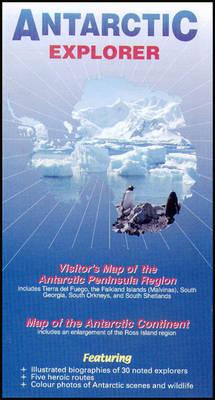
A foldout map of Antarctica. It features many colour photographs of seals, penguins and other Antarctic wildlife, together with an inset box summarising the Antarctic Treaty and other information on Antarctic waters, Cape Horn, Tierra del Fuego, the Beagle Channel, the Falkland Islands and South Georgia.
This is an excellent foldout map of Antarctica. On one side there is a map of the Antarctic continent, around which succinct biographies of Antarctic explorers from William Spiers Bruce to Edward Wilson are shown. On the other side there are many fine colour photographs of seals, penguins and other Antarctic wildlife, together with an inset box summarising the Antarctic Treaty and other information on Antarctic waters, Cape Horn, Tierra del Fuego, the Beagle Channel, the Falkland Islands and South Georgia. It is aimed at visitors arriving by sea.
This is an excellent foldout map of Antarctica. On one side there is a map of the Antarctic continent, around which succinct biographies of Antarctic explorers from William Spiers Bruce to Edward Wilson are shown. On the other side there are many fine colour photographs of seals, penguins and other Antarctic wildlife, together with an inset box summarising the Antarctic Treaty and other information on Antarctic waters, Cape Horn, Tierra del Fuego, the Beagle Channel, the Falkland Islands and South Georgia. It is aimed at visitors arriving by sea.
Map of Antarctica including Tierra del Fuego, the Falkland Islands (Malvinas), South Georgia, South Orkneys and South Shetlands (1:2750000); map of the Antarctic continent including an enlargement of the Ross Island region (1:12250000); the explorers; the Antarctic Treaty.
| Reihe/Serie | Ocean Explorer Maps |
|---|---|
| Zusatzinfo | Col photos |
| Verlagsort | Chichester |
| Sprache | englisch |
| Maße | 170 x 240 mm |
| Themenwelt | Reisen ► Karten / Stadtpläne / Atlanten ► Welt / Arktis / Antarktis |
| ISBN-10 | 0-9538618-7-2 / 0953861872 |
| ISBN-13 | 978-0-9538618-7-3 / 9780953861873 |
| Zustand | Neuware |
| Informationen gemäß Produktsicherheitsverordnung (GPSR) | |
| Haben Sie eine Frage zum Produkt? |
Mehr entdecken
aus dem Bereich
aus dem Bereich
Karte (gerollt) (2024)
Kümmerly+Frey (Verlag)
14,90 €


