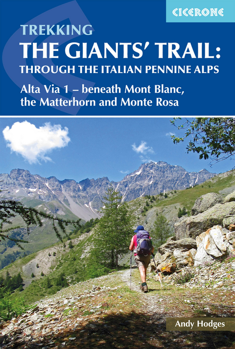
Trekking the Giants' Trail: Alta Via 1 through the Italian Pennine Alps
Cicerone Press (Verlag)
978-1-85284-992-4 (ISBN)
A guidebook to trekking the Alta Via 1, the Giants’ Trail, between Donnas and Courmayeur in the Italian Alps. Covering 180km (112 miles), this long-distance trail on the northern flank of the Aosta valley takes around 2 weeks to hike and is suitable for hikers with some experience of Alpine trekking.
The route is described from east to west in 16 stages, each between 4 and 17km (2–11 miles) in length. Alternative stages covering some popular variants, including an optional detour to visit the famed monastery at the Great St Bernard Pass, are also detailed.
1:50,000 maps included for each stage
GPX files available to download
Refreshment, facilities and mountain hut information given for each trek stage
Spectacular views of the alpine giants Mont Blanc, the Matterhorn and Monte Rosa
Can be combined with Alta Via 2 to form the Tor des Géants
Andy was born and bred in northern England and developed his early mountain skills in the Lake District and Snowdonia. Since discovering the joys of the Alps in 1999, Andy and his wife have explored much of the Western Alps, walking, running, cycling, ski-touring and snowshoeing. Since the late 1980s Andy has enjoyed leading others in the mountains and recently completed the in-depth training and assessments to become an International Mountain Leader.
Map key
Overview map
Route summary table
Introduction
The route
Geography
Geology
History
Art and culture
Wildlife
Plants and flowers
Weather
When to go
Access and travel
In-route transport options
Accommodation
Mountain huts
Clothing
Food and drink
Language
Maps and navigation
Waymarking
Safety and emergencies
Insurance
Using this guide
The Alta Via 1: An Italian Haute Route
Eastern section
Stage 1 Donnas to Sassa (Etoile du Berger)
Stage 2 Sassa (Etoile du Berger) to Rifugio Coda
Stage 2A The Col Portola Route: Sassa (Etoile du Berger) to Rifugio Coda
Stage 3 Rifugio Coda to Rifugio Barma
Stage 4 Rifugio Barma to Niel (La Gruba)
Stage 5 Niel (La Gruba) to Gressoney-Saint-Jean
Stage 3A Rifugio Coda to Rifugio della Vecchia
Stage 4A Rifugio della Vecchia to Rifugio Rivetti
Stage 5A Rifugio Rivetti to Gressoney-Saint-Jean
Stage 6 Gressoney-Saint-Jean to Rifugio Vieux Crest
Stage 7 Rifugio Vieux Crest to Rifugio Grand Tournalin
Stage 8 Rifugio Grand Tournalin to Cretaz, Valtournenche
Western section
Stage 9 Cretaz, Valtournenche to Rifugio Barmasse
Stage 10 Rifugio Barmasse to Rifugio Cun&##xe9;y
Stage 11 Rifugio Cun&##xe9;y to Clos&##xe9;/Oyace/Lexert
Stage 12 Clos&##xe9;/Oyace/Lexert to Ollomont/Rey
Stage 12A Clos&##xe9;/Oyace/Lexert to Ollomont/Rey: the low route
Stage 13 Ollomont/Rey to Rifugio Champillon
Stage 14 Rifugio Champillon to Saint-Rh&##xe9;my-en-Bosses
Stage 15 Saint-Rh&##xe9;my-en-Bosses to Rifugio Bonatti
Stage 15A Via Francigena from Saint-Rh&##xe9;my-en-Bosses to Great St Bernard Monastery
Stage 15B Great St Bernard Monastery to Rifugio Bonatti
Stage 16 Rifugio Bonatti to Courmayeur
Appendix A Alternative schedule
Appendix B Useful contacts
Appendix C Useful phrases
Appendix D Kit list
| Erscheinungsdatum | 24.02.2021 |
|---|---|
| Reihe/Serie | Cicerone guidebooks |
| Zusatzinfo | 24 maps, 23 elevation profiles and 50 colour photos |
| Verlagsort | Kendal |
| Sprache | englisch |
| Maße | 116 x 172 mm |
| Gewicht | 220 g |
| Themenwelt | Sachbuch/Ratgeber ► Sport |
| Reisen ► Sport- / Aktivreisen ► Europa | |
| ISBN-10 | 1-85284-992-4 / 1852849924 |
| ISBN-13 | 978-1-85284-992-4 / 9781852849924 |
| Zustand | Neuware |
| Haben Sie eine Frage zum Produkt? |
aus dem Bereich
