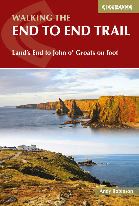
Walking The End to End Trail
Cicerone Press (Verlag)
978-1-85284-933-7 (ISBN)
This guidebook to UK's ultimate challenge walk, the End to End, describes a 1956km (1215 mile) walking route from Land's End in Cornwall to John o' Groats in Scotland's far north - the two points on mainland Britain that are the furthest apart. The recommended route avoids road walking as much as possible and frequently takes advantage of existing long-distance trails, including the South West Coast Path, Pennine Way and West Highland Way. Passing through remote terrain at times and keeping to the hills where practical, it is intended for experienced hill-walkers.
The guide includes route description and maps, concentrating on the 'gaps' between the major long-distance trails covered in other Cicerone guides. There is also a wealth of advice to help you prepare for and undertake your walk, covering equipment, safety, supplies and facilities. Notes on history, geography and local sights, along with anecdotes from those who have successfully completed the journey, add interest and inspiration.
The route is presented in 61 daily stages (each averaging around 32km), divided into 6 sections; an alternative three-month schedule is also provided. The End to End Trail promises a magnificent adventure through some of the best the British countryside can offer, and a unique sense of achievement on completion of your walk.
Andy Robinson has been walking around the hills and mountains for more years than he cares to admit to, and is a mean hand with a map and compass. He has a habit of setting off on unreasonably optimistic expeditions and usually gets away with it. But not always. His family is very supportive and puts up with a lot, but he's not quite sure why.
Map key
Route overview map
Preface to the second edition
INTRODUCTION
Using this guide
The route
Geography and history
Safety
When to go
Planning your schedule
Equipment
Maps
Carrying food
Money
Accommodation and services
SECTION 1 THE SOUTH WEST COAST PATH: LAND'S END TO BARNSTAPLE
The start Land's End
Day 1 Land's End to Zennor
Day 2 Zennor to Gwithian
Day 3 Gwithian to Perranporth
Day 4 Perranporth to Mawgan Porth
Day 5 Mawgan Porth to Wadebridge
Day 6 Wadebridge to Boscastle
Day 7 Boscastle to Bude
Day 8 Bude to Clovelly
Day 9 Clovelly to Barnstaple
Section 1 Strip maps
SECTION 2 THE BRISTOL CHANNEL AND THE WELSH BORDER: BARNSTAPLE TO KNIGHTON
Day 10 Barnstaple to Warren Farm, Exmoor
Day 11 Warren Farm, Exmoor, to Roadwater
Day 12 Roadwater to Bridgwater
Day 13 Bridgwater to Cheddar
Day 14 Cheddar to Easton-in-Gordano
Day 15 Easton-in-Gordano to Chepstow
Day 16 Chepstow to Monmouth
Day 17 Monmouth to Pandy
Day 18 Pandy to Hay-on-Wye
Day 19 Hay-on-Wye to Knighton
Section 2 Strip maps
SECTION 3 SHROPSHIRE, STAFFORDSHIRE AND THE PEAK: KNIGHTON TO HEBDEN BRIDGE
Day 20 Knighton to Craven Arms
Day 21 Craven Arms to Ironbridge
Day 22 Ironbridge to Penkridge
Day 23 Penkridge to Abbots Bromley
Day 24 Abbots Bromley to Thorpe
Day 25 Thorpe to Youlgreave
Day 26 Youlgreave to Hathersage
Day 27 Hathersage to White Gate
Day 28 White Gate to Hebden Bridge
Section 3 Strip maps
SECTION 4 THE PENNINES AND CHEVIOTS: HEBDEN BRIDGE TO JEDBURGH
Day 29 Hebden Bridge to Thornton in Craven
Day 30 Thornton in Craven to Horton in Ribblesdale
Day 31 Horton in Ribblesdale to Hawes
Day 32 Hawes to Keld
Day 33 Keld to Middleton-in-Teesdale
Day 34 Middleton-in-Teesdale to Dufton
Day 35 Dufton to Alston
Day 36 Alston to Greenhead
Day 37 Greenhead to Bellingham
Day 38 Bellingham to Byrness
Day 39 Byrness to Jedburgh
Section 4 Strip maps
SECTION 5 SOUTHERN SCOTLAND AND THE WEST HIGHLAND WAY: JEDBURGH TO FORT WILLIAM
Day 40 Jedburgh to Melrose
Day 41 Melrose to Traquair
Day 42 Traquair to West Linton
Day 43 West Linton to Linlithgow
Day 44 Linlithgow to Kilsyth
Day 45 Kilsyth to Drymen
Day 46 Drymen to Inverarnan
Day 47 Inverarnan to Bridge of Orchy
Day 48 Bridge of Orchy to Kinlochleven
Day 49 Kinlochleven to Fort William
Section 5 Strip maps
SECTION 6 THE NORTHERN HIGHLANDS AND THE FLOW COUNTRY: FORT WILLIAM TO JOHN O' GROATS
Day 50 Fort William to Glen Garry (Loch Poulary)
Day 51 Glen Garry (Loch Poulary) to Glen Affric
Day 52 Glen Affric to Bendronaig Lodge
Day 53 Bendronaig Lodge to Kinlochewe
Day 54 Kinlochewe to Inverlael
Day 55 Inverlael to Oykel Bridge
Day 56 Oykel Bridge to the Overscaig Hotel
Day 57 The Overscaig Hotel to the Crask Inn
Day 56L Oykel Bridge to Lairg
Day 57L Lairg to Loch Choire
Day 58 The Crask Inn to Kinbrace
Day 59 Kinbrace to River Thurso (Dail Righe)
Day 60 River Thurso (Dail Righe) to Watten
Day 61 Watten to Duncansby Head and John o' Groats
The end John o' Groats
How to leave John o' Groats
Recognition of your feat
Section 6 Strip maps
Appendix A Route summary tables
Main schedule
Alternative three-month schedule
Appendix B Bibliography
Appendix C Other sources of information
| Erscheinungsdatum | 13.09.2019 |
|---|---|
| Reihe/Serie | Cicerone guidebooks |
| Verlagsort | Kendal |
| Sprache | englisch |
| Maße | 116 x 172 mm |
| Gewicht | 460 g |
| Themenwelt | Sachbuch/Ratgeber ► Sport |
| Reiseführer ► Europa ► Großbritannien | |
| Reisen ► Sport- / Aktivreisen ► Europa | |
| ISBN-10 | 1-85284-933-9 / 1852849339 |
| ISBN-13 | 978-1-85284-933-7 / 9781852849337 |
| Zustand | Neuware |
| Haben Sie eine Frage zum Produkt? |
aus dem Bereich


