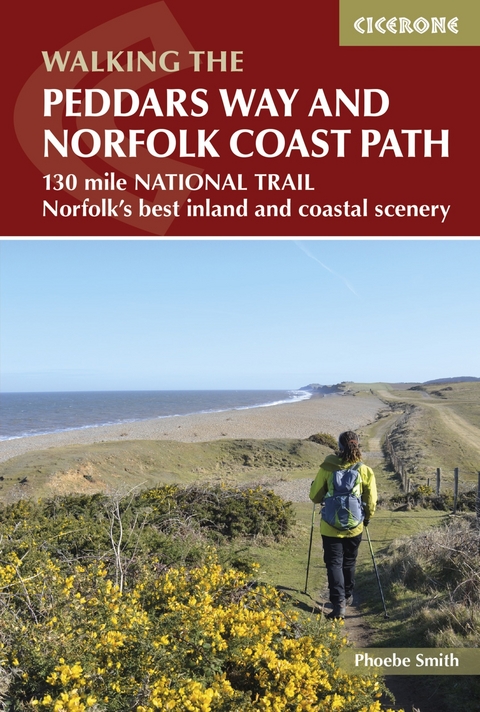
The Peddars Way and Norfolk Coast Path
Cicerone Press (Verlag)
978-1-85284-750-0 (ISBN)
A guidebook to walking the 216 km (133 miles) Peddars Way and Norfolk Coast Path National Trail that combines Norfolk’s inland and coastal scenery. The route can be completed in eleven days with the possibility of breaking the walk into shorter sections.
Described in 11 stages, the distance covered spans between 12 and 29 kms (6-18 miles) each day. The Peddars Way is followed from south to north, starting at Knettishall Heath in Suffolk and joining the Norfolk Coast Path at Holme-next-the-Sea. The route ends at Hopton-on-Sea on the Norfolk-Suffolk border.
1:50,000 OS mapping and step-by-step descriptions for each stage
Centres include Knettishall, Little Cressingham, Castle Acre, Snettisham, Hunstanton, Brancaster, Wells next to the Sea, Blakeney, Sheringham, Cromer, Mundesley, Sea Palling and Great Yarmouth
Information about local history and wildlife
Easy access to public transport links throughout the route
Handy route summary table, plus comprehensive planning information
Phoebe is award-winning editor of Wanderlust travel magazine and has written extensively for a range of newspapers and magazines, both in the UK and overseas, and is also the author of several books on wild camping. She was a finalist in the 2015 National Adventurer Awards, and in 2014 became the first woman to camp at all the extreme points of mainland Britain on consecutive nights.
Map key
Overview map
Introduction
Geology
History of Norfolk
History of the trail
Wildlife
Plants and flowers
Art
What to take
Waymarking, access and maps
Emergencies
Using this guide
Getting there
Getting around
When to go
In which direction?
Accommodation
Health and safety
Practicalities
Stage 1 Knettishall Heath to Little Cressingham
Stage 2 Little Cressingham to Castle Acre
Stage 3 Castle Acre to Sedgeford
Stage 4 Sedgeford to Hunstanton
Stage 5 Hunstanton to Burnham Deepdale
Stage 6 Burnham Deepdale to Stiffkey
Stage 7 Stiffkey to Cley next the Sea
Stage 8 Cley next the Sea to Cromer
Stage 9 Cromer to Sea Palling
Stage 10 Sea Palling to Caister-on-Sea
Stage 11 Caister-on-Sea to Hopton-on-Sea
Appendix A Route summary table
Appendix B Useful contacts
| Erscheinungsdatum | 29.05.2019 |
|---|---|
| Reihe/Serie | Cicerone guidebooks |
| Zusatzinfo | colour photos and 1:50,000 OS map extracts |
| Verlagsort | Kendal |
| Sprache | englisch |
| Maße | 116 x 172 mm |
| Gewicht | 170 g |
| Themenwelt | Sachbuch/Ratgeber ► Sport |
| Reiseführer ► Europa ► Großbritannien | |
| Reisen ► Sport- / Aktivreisen ► Europa | |
| ISBN-10 | 1-85284-750-6 / 1852847506 |
| ISBN-13 | 978-1-85284-750-0 / 9781852847500 |
| Zustand | Neuware |
| Haben Sie eine Frage zum Produkt? |
aus dem Bereich


