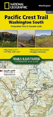
Pacific Crest Trail, Washington South
Topographic Map Guide
Seiten
2019
|
2024th ed.
National Geographic Maps (Verlag)
978-1-56695-709-0 (ISBN)
National Geographic Maps (Verlag)
978-1-56695-709-0 (ISBN)
The Washington South Topographic Map Guide follows the Pacific Crest Trail (PCT) as it travels through a landscape dotted with lakes, perennial snowfields, and small glaciers. In the heavily eroded, rugged mountains of central Washington, the PCT crosses steep ridges and high mountain passes. The trail skirts the base of Mount Adams and its volcanic fields covered in large lava flows and avalanche debris. As the PCT approaches the Oregon border it dramatically drops into the Columbia River Gorge and passes over the Columbia River on the Bridge of the Gods. The PCT spans 2,650 miles from the Canadian border, through Washington, Oregon, and California to the southern terminus on the Mexican border. The famous trail crosses some of the most wild and scenic landscapes of the western U.S., including six national parks, 25 national forests, 48 wilderness areas, the volcanic Cascade Range of the Pacific Northwest, the snowcapped Sierra Nevada, and the Mojave and Sonoran deserts. Each PCT Top
| Erscheinungsdatum | 26.11.2018 |
|---|---|
| Zusatzinfo | 1 Illustrations, unspecified |
| Sprache | englisch |
| Maße | 108 x 235 mm |
| Themenwelt | Reisen ► Karten / Stadtpläne / Atlanten |
| ISBN-10 | 1-56695-709-5 / 1566957095 |
| ISBN-13 | 978-1-56695-709-0 / 9781566957090 |
| Zustand | Neuware |
| Haben Sie eine Frage zum Produkt? |
Mehr entdecken
aus dem Bereich
aus dem Bereich
Buch | Hardcover (2022)
Klett (Verlag)
30,95 €


