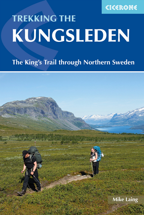
Trekking the Kungsleden
Cicerone Press (Verlag)
978-1-85284-982-5 (ISBN)
A guidebook to walking the Kungsleden trail (King’s Trail) between Abisko and Hemavan. Covering 460km (286 miles), this long-distance trail through the sub-artic landscape of Swedish Lappland takes 4 weeks and is suitable for any reasonably fit, experienced walker.
The route is described from north to south in 28 stages, each between 7 and 22km (4–14 miles) in length. An additional itinerary is included for the Kebnekaise summit, Sweden’s highest peak.
1:100,000 maps included for each stage
GPX files available to download
Detailed information on accommodation, facilities and public transport
The popular Abisko-Nikkaluokta portion of the route can be completed in 1 week
Advice on planning and preparation
Mike Laing is a freelance mountaineering instructor based in Snowdonia, North Wales. He has travelled, climbed and trekked extensively in Greenland, South America, Africa, Europe and the Himalaya.
Map key
Overview map
Route summary table
Introduction
The subarctic environment
Plants and animals
Regional history
When to go
Planning your walk
Transport
Boat crossings
Accommodation
Hut life and facilities
The truth about sauna
Trail marking and access
What to take
Mapping and GPS
Communications and electronics
Resupply
Safety and wellbeing
Using this guide
Section 1 - Abisko to Saltoluokta
Stage 1 Abisko to Abiskojaure
Stage 2 Abiskojaure to Alesjaure
Stage 3 Alesjaure to Tjäktja
Stage 4 Tjäktja to Sälka
Stage 5 Sälka to Singi
Stage 6 Singi to Kaitumjaure
Stage 7 Kaitumjaure to Teusajaure
Stage 8 Teusajaure to Saltoluokta via Vakkotavare
Additional itineraries
Additional itinerary 1 Singi to Nikkaluokta (alternative finish to Section 1)
Additional itinerary 2 Kebnekaise summit
Section 2 - Saltoluokta to Kvikkjokk
Stage 9 Saltoluokta to Sitojaure
Stage 10 Sitojaure to Aktse
Stage 11 Aktse to Pårte
Stage 12 Pårte to Kvikkjokk
Section 3 - Kvikkjokk to Jäkkvik
Stage 13 Kvikkjokk to Tsielekjåkkå
Stage 14 Tsielekjåkkå to Gistoj&##xe1;vr&##xe1;tj
Stage 15 Gistoj&##xe1;vr&##xe1;tj to G&##xe1;sakl&##xe1;hko
Stage 16 G&##xe1;sakl&##xe1;hko to Vuonatjviken
Stage 17 Vuonatjviken to Jäkkvik
Section 4 - Jäkkvik to Ammarnäs
Stage 18 Jäkkvik to Luvt&##xe1;vrre
Stage 19 Luvt&##xe1;vrre to Bäverholmen
Stage 20 Bäverholmen to Tjiegnatisj&##xe1;vrrie
Stage 21 Tjiegnatisj&##xe1;vrrie to Rävfalls
Stage 22 Rävfalls to Ammarnäs
Section 5 - Ammarnäs to Hemavan
Stage 23 Ammarnäs to Aigert
Stage 24 Aigert to Serve
Stage 25 Serve to Tärnasjö
Stage 26 Tärnasjö to Syter
Stage 27 Syter to Viterskals
Stage 28 Viterskals to Hemavan
Appendix A Summary of facilities
Appendix B Useful contacts
Appendix C Summary of boat crossings
Appendix D Language
| Erscheinungsdatum | 17.05.2019 |
|---|---|
| Reihe/Serie | Cicerone guidebooks |
| Zusatzinfo | 38 maps, 32 elevation profiles, 100 colour photos |
| Verlagsort | Kendal |
| Sprache | englisch |
| Maße | 116 x 172 mm |
| Gewicht | 320 g |
| Themenwelt | Sachbuch/Ratgeber ► Sport |
| Reiseführer ► Europa ► Schweden | |
| Reisen ► Sport- / Aktivreisen ► Europa | |
| ISBN-10 | 1-85284-982-7 / 1852849827 |
| ISBN-13 | 978-1-85284-982-5 / 9781852849825 |
| Zustand | Neuware |
| Haben Sie eine Frage zum Produkt? |
aus dem Bereich


