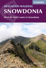
Hillwalking in Snowdonia
Cicerone Press (Verlag)
978-1-85284-349-6 (ISBN)
- Titel ist leider vergriffen;
keine Neuauflage - Artikel merken
A guidebook to nearly 70 hillwalking routes throughout Snowdonia in Wales, including the central areas of the Carneddau, Glyders and Snowdon, as well as outlying areas of the Moelwyns, Eifionydd, Rhinogs, Arenigs and Cader Idris. Each area has its own peculiar charm and the areas also vary in terms of popularity. Snowdon attracts a lot of first-time visitors and is in constant use during holiday and weekend periods, while venturing into the lower and less rugged mountains outside the three main areas will mean meeting only a handful of people.
Steve lived in Snowdonia for 20 years, during which he gained an intimate knowledge of walks and climbs in the region. Among a number of mountaineering books he wrote at this time, the best known is his highly influential and now classic Scrambles in Snowdonia, which was largely responsible for reviving interest in this esoteric sport. For several years Steve was a columnist for High Mountain Sports and Country Living magazines. He currently works as an actor and playwright.
CARNEDDAU
1: Carneddau North
1.1 Carnedd Llewelyn via Drum
1.2 Carnedd Llewelyn via Aber Falls
1.3 Drosgl - Foel Fras - Drum
2: Carneddau West
2.1 Carnedd Dafydd from Gerlan
2.2 Carnedd Llewelyn from Gerlan
2.3 Carnedd Llewelyn via Yr Elen
2.4 Cwm Llafar Horseshoe
3: Carneddau South
3.1 Carnedd Dafydd from Ogwen Cottage
3.2 Pen yr Ole Wen from Tal y Llyn
3.3 Carnedd Dafydd via Ffynnon Llugwy
3.4 Carnedd Llewelyn via Ffynnon Llugwy
3.5 Pen yr Helgi Du via Y Braich
3.6 Dafydd - Llewelyn - Helgi Du
4: Carneddau East
4.1 Pen Llithrig y Wrach from Capel Curig
4.2 Pen Llithrig y Wrach - Pen yr Helgi Du
4.3 Creigiau Gleision from Capel Curig
4.4 Creigiau Gleision and Crafnant
5: Carneddau North-East
5.1 Carnedd Llewelyn via Foel Grach
5.2 Carnedd Llewelyn via Cwm Eigiau
5.3 Pen Llithrig y Wrach from Llyn Eigiau
5.4 Cwm Eigiau Horseshoe
GLYDERS
6: Glyders West
6.1 Y Garn from Nant Peris
6.2 Y Garn - Foel Goch - Elidir Fawr
6.3 Y Garn North-East Ridge
6.4 Y Garn via Devil's Kitchen
7: Glyders North
7.1 Glyders Fawr via Devil's Kitchen
7.2 Glyder Fawr via Cwm Cneifion
7.3 Glyder Fawr via Y Gribin
7.4 Glyder Fach via Cwm Bochlwyd
7.5 Glyder Fach via Bristly Ridge
7.6 The Glyders from Ogwen
8: Glyders East
8.1 Tryfan North Ridge
8.2 Tryfan via Heather Terrace
8.3 Cwm Tryfan and Tryfan South Ridge
8.4 Cwm Bochlwyd Horseshoe
8.5 Glyder Fach via Braich y Ddeugwm
8.6 Glyder Fach from Capel Curig
9: Glyders South
9.1 Glyder Fawr from Pen y Pass
9.2 Glyder Fach from Pen y Gwryd
9.3 Glyders from the south
SNOWDON
10: Snowdon North-West
10.1 Snowdon via the Llanberis Path
10.2 Snowdon via the Llanberis ridge
10.3 Moel Eilio group from Llanberis
10.4 Snowdon via Moel Eilio
10.5 Snowdon from the Snowdon Ranger
10.6 Moel Cynghorion from the Snowdon Ranger
11: Snowdon East
11.1 Snowdon via the Pig Track
11.2 Snowdon via Crib Goch
11.3 Snowdon via the Miners Track
11.4 Snowdon via Y Gribin
11.5 Snowdon via Lliwedd
11.6 Snowdon Horseshoe
12: Snowdon South
12.1 Snowdon via the Watkin Path
12.2 Snowdon South Ridge
12.3 y Aran from Nant Gwynant
12.4 Snowdon from Rhyd Ddu
OUTLYING AREAS
13: Moelwyns
13.1 Moel Siabod from Pont Cyfyng
13.2 Cnicht from Nanmor
13.3 Cnicht and the Moelwyns from Croesor
14: Eifionydd
14.1 Moel Hebog and Moel Lefn from Beddgelert
14.2 Trum y Ddysgl from Rhyd Ddu
14.3 Nantlle Ridge
14.4 Mynydd Mawr from Snowdon Ranger
15:Southern Snowdonia
15.1 Rhinog Fawr via the Roman Steps
15.2 Cader Idris from the north
15.3 Cader Idris from Minffordd
15.4 Aran Ridge
15.5 Arenig Fawr
| Erscheint lt. Verlag | 22.8.2013 |
|---|---|
| Zusatzinfo | colour photographs and maps |
| Verlagsort | Kendal |
| Sprache | englisch |
| Maße | 116 x 172 mm |
| Gewicht | 200 g |
| Themenwelt | Sachbuch/Ratgeber ► Sport |
| Reiseführer ► Europa ► Großbritannien | |
| ISBN-10 | 1-85284-349-7 / 1852843497 |
| ISBN-13 | 978-1-85284-349-6 / 9781852843496 |
| Zustand | Neuware |
| Haben Sie eine Frage zum Produkt? |
aus dem Bereich


