Two Moors Way Map Booklet
Cicerone Press (Verlag)
978-1-78631-007-1 (ISBN)
All the mapping you need to complete the Two Moors Way, Devon's coast to coast route between Wembury Bay and Lynmouth, including a section of the Erme-Plym Trail.
NOTE: An accompanying Cicerone guidebook - The Two Moors Way - describes the route south to north, with summary directions for walking north to south. It includes lots of other practical information and background notes on points of interest along the route, for those who prefer a written guide. The accompanying guidebook INCLUDES a copy of this map booklet.
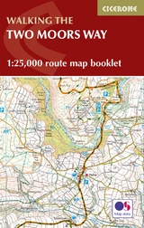
This booklet of Ordnance Survey 1:25,000 Explorer maps has been designed for convenient use on the trail. It shows the full and up-to-date line of the Two Moors Way, along with the relevant extract from the OS Explorer map legend. It is conveniently sized for slipping into a jacket pocket or top of a rucksack.
After gaining a degree in Geography and Archaeology at Exeter University Sue Viccars worked for a London map publisher before grabbing the chance to return to Devon, where she spent 20 years commissioning walking, equestrian and countryside books for David & Charles Publishers. She received her first walking book commission three weeks after going freelance in 2000 and since then has written or contributed to around 20 books (and edited dozens more), specialising in her home territory of southwest England, with particular reference to Dartmoor and Exmoor. She writes the walks for Exmoor: the country magazine, and has been editor of Dartmoor Magazine since 2008.
The Two Moors Way
Stage 1 Wembury to Yealmpton
Stage 2 Yealmpton to Ivybridge
Stage 3 Ivybridge to Holne
Stage 3A Ivybridge to Holne (low-level route)
Stage 4 Holne to Dunstone Down
Stage 5 Dunstone Down to Chagford Bridge
Stage 5A Dunstone Down to Chagford Bridge (low-level route)
Stage 6 Chagford Bridge to Morchard Road
Stage 7 Morchard Road to Witheridge
Stage 8 Witheridge to Knowstone
Stage 9 Knowstone to Tarr Steps
Stage 10 Tarr Steps to Simonsbath
Stage 11 Simonsbath to Lynmouth
| Erscheinungsdatum | 15.03.2019 |
|---|---|
| Reihe/Serie | Cicerone guidebooks |
| Verlagsort | Kendal |
| Sprache | englisch |
| Maße | 106 x 166 mm |
| Gewicht | 880 g |
| Themenwelt | Sachbuch/Ratgeber ► Sport |
| Reisen ► Karten / Stadtpläne / Atlanten ► Europa | |
| Reiseführer ► Europa ► Großbritannien | |
| Reisen ► Sport- / Aktivreisen | |
| ISBN-10 | 1-78631-007-4 / 1786310074 |
| ISBN-13 | 978-1-78631-007-1 / 9781786310071 |
| Zustand | Neuware |
| Informationen gemäß Produktsicherheitsverordnung (GPSR) | |
| Haben Sie eine Frage zum Produkt? |
aus dem Bereich