London
Seiten
2018
National Geographic Maps (Verlag)
978-1-56695-782-3 (ISBN)
National Geographic Maps (Verlag)
978-1-56695-782-3 (ISBN)
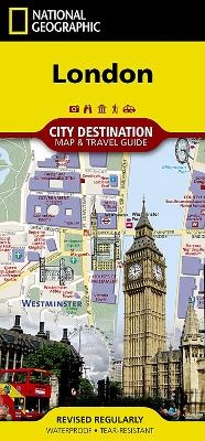
CityDestinationMaps blend urban guidebook information with easy to read street maps, complete with 3D buildings. The maps are printed on waterproof, tear-resistant material that's lightweight yet very durable - idea for travel. In addition to the easy-to-read map on the front with a map of the London Underground, the back of this London map includes: Regional map; Points of interest; Airport diagrams for Heathrow and Gatwick; Inset map for Hyde Park and Kensington; Information on transportation, museums, and more; and a multi-language legend.
| Erscheint lt. Verlag | 8.5.2018 |
|---|---|
| Verlagsort | Evergreen |
| Sprache | englisch |
| Maße | 105 x 225 mm |
| Gewicht | 42 g |
| Themenwelt | Reisen ► Karten / Stadtpläne / Atlanten ► Europa |
| Reiseführer ► Europa ► Großbritannien | |
| ISBN-10 | 1-56695-782-6 / 1566957826 |
| ISBN-13 | 978-1-56695-782-3 / 9781566957823 |
| Zustand | Neuware |
| Haben Sie eine Frage zum Produkt? |
Mehr entdecken
aus dem Bereich
aus dem Bereich
Explore Scotland’s Ancient Monuments
Karte (gefalzt) (2024)
Collins (Verlag)
9,95 €


