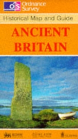
Ancient Britain
1990
Ordnance Survey (Verlag)
978-0-319-29001-9 (ISBN)
Ordnance Survey (Verlag)
978-0-319-29001-9 (ISBN)
- Titel erscheint in neuer Auflage
- Artikel merken
Zu diesem Artikel existiert eine Nachauflage
Historical Maps. Only two maps in this series, comprising Ancient Britain and Roman Britain. Produced in conjunction with the Royal Commissions on Historical Monuments for England, Scotland and Wales.
Ordnance Survey is Britain's national mapping agency, responsible for the official, definitive mapping of the whole country. They produce and market a wide range of maps for educational and leisure purposes, as well as producing computer data products for government, business and administrative use.
| Reihe/Serie | Historical Map and Guide |
|---|---|
| Verlagsort | Hants |
| Sprache | englisch |
| Themenwelt | Sachbuch/Ratgeber ► Geschichte / Politik ► Regional- / Landesgeschichte |
| Reisen ► Karten / Stadtpläne / Atlanten ► Europa | |
| Geschichte ► Allgemeine Geschichte ► Vor- und Frühgeschichte | |
| Geisteswissenschaften ► Geschichte ► Hilfswissenschaften | |
| ISBN-10 | 0-319-29001-8 / 0319290018 |
| ISBN-13 | 978-0-319-29001-9 / 9780319290019 |
| Zustand | Neuware |
| Haben Sie eine Frage zum Produkt? |
