Walking in Northumberland (eBook)
216 Seiten
Cicerone Press (Verlag)
978-1-78362-602-1 (ISBN)
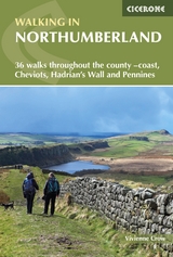
Vivienne is an award-winning freelance writer and photographer specialising in travel and the outdoors. Based in north Cumbria, she has put her intimate knowledge of northern England to good use, writing more than a dozen popular walking guidebooks. She also contributes to a number of regional and national magazines, including several regular walking columns. Vivienne is a member of the Outdoor Writers and Photographers Guild.
Map key
Overview map
Introduction
Weather
Geology
Wildlife and habitats
History
Where to stay
Public transport
Maps
Waymarking and access
Dogs
Clothing, equipment and safety
Using this guide
Northeast Northumberland, including the coast
Walk 1 Craster and Howick Hall
Walk 2 Dunstanburgh Castle and Low Newton
Walk 3 Seahouses to Belford
Walk 4 Lindisfarne
Walk 5 Berwick-upon-Tweed to Eyemouth
Walk 6 Norham Castle and River Tweed
Walk 7 St Cuthbert's Cave and the Kyloe Hills
Walk 8 Doddington Moor
Walk 9 Bewick Moor
National Park (north) including the Cheviot Hills
Walk 10 Yeavering Bell from Wooler
Walk 11 Great Hetha, the border and Ring Chesters
Walk 12 The Cheviot
Walk 13 Ancient Ingram
Walk 14 Breamish Valley and Salter's Road
Walk 15 Harbottle
Walk 16 Wether Cairn
Walk 17 Clennell Street and Usway Burn
Walk 18 Border Ridge including Windy Gyle
Walk 19 Thrunton Wood
Walk 20 Rothbury Terraces
Walk 21 The Simonside Hills
Kielder
Walk 22 Tarsetdale Bastles
Walk 23 Bull Crag Peninsula
Walk 24 Cat Cairn, Lewis Burn and Lakeside Way (south)
Walk 25 Kielder Forest and Lakeside Way (north)
Walk 26 Deadwater Fell and Peel Fell
Tyne Valley and National Park (south) including Hadrian's Wall
Walk 27 Heavenfield and Wall
Walk 28 Hadrian's Wall and Greenlee Lough
Walk 29 Vindolanda and Crag Lough
Walk 30 Best of Hadrian's Wall
Walk 31 Haltwhistle and the South Tyne
Walk 32 Hadrian's Wall Path and Thirlwall Castle
North Pennines
Walk 33 Allenmill Flues
Walk 34 Above Allenheads
Walk 35 Blanchland Moor
Walk 36 Birkside Fell and Beldon Burn
Appendix A Route summary table
Appendix B Useful contacts
| Erscheint lt. Verlag | 10.1.2024 |
|---|---|
| Zusatzinfo | More than 90 photos and 36 OS maps |
| Verlagsort | Kendal |
| Sprache | englisch |
| Themenwelt | Sachbuch/Ratgeber ► Sport |
| Reisen ► Reiseführer | |
| Schlagworte | Bamburgh • Craster • Dunstanburgh Castle • Guidebook • Haltwhistle • hike • kielder water • OS map • Wooler |
| ISBN-10 | 1-78362-602-X / 178362602X |
| ISBN-13 | 978-1-78362-602-1 / 9781783626021 |
| Haben Sie eine Frage zum Produkt? |
Kopierschutz: Adobe-DRM
Adobe-DRM ist ein Kopierschutz, der das eBook vor Mißbrauch schützen soll. Dabei wird das eBook bereits beim Download auf Ihre persönliche Adobe-ID autorisiert. Lesen können Sie das eBook dann nur auf den Geräten, welche ebenfalls auf Ihre Adobe-ID registriert sind.
Details zum Adobe-DRM
Dateiformat: EPUB (Electronic Publication)
EPUB ist ein offener Standard für eBooks und eignet sich besonders zur Darstellung von Belletristik und Sachbüchern. Der Fließtext wird dynamisch an die Display- und Schriftgröße angepasst. Auch für mobile Lesegeräte ist EPUB daher gut geeignet.
Systemvoraussetzungen:
PC/Mac: Mit einem PC oder Mac können Sie dieses eBook lesen. Sie benötigen eine
eReader: Dieses eBook kann mit (fast) allen eBook-Readern gelesen werden. Mit dem amazon-Kindle ist es aber nicht kompatibel.
Smartphone/Tablet: Egal ob Apple oder Android, dieses eBook können Sie lesen. Sie benötigen eine
Geräteliste und zusätzliche Hinweise
Buying eBooks from abroad
For tax law reasons we can sell eBooks just within Germany and Switzerland. Regrettably we cannot fulfill eBook-orders from other countries.
aus dem Bereich