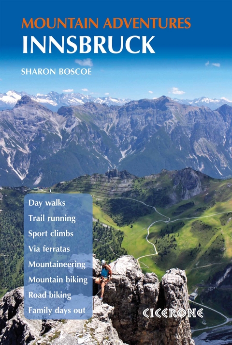
Innsbruck Mountain Adventures
Cicerone Press (Verlag)
978-1-85284-958-0 (ISBN)
This guidebook presents 60 routes covering some of the best day walks, scrambles, hut-to-hut walks, alpine mountaineering, sport climbing, via ferratas, mountain-biking routes, road rides, city and trail runs and family activities the Innsbruck area has to offer.
Ideal for a multi-activity holiday or for the keen amateur seeking a summary of the local highlights, it includes suggestions to suit most abilities and ambitions, from gentle strolls to adrenalin-filled mountain adventures, suitable only for those with the appropriate equipment and experience. Nearly all the activities are accessible by public transport from Innsbruck and many take advantage of the region's fantastic network of alpine huts.
Route descriptions are illustrated with maps, profiles and photo topos, and you'll also find practical advice on transport, accommodation and equipment. Long popular as a winter sports destination, Innsbruck also has much to offer the summer visitor, with many kilometres of paths and trails, sport climbing crags, via ferrata routes and engaging activity trails for children.
Originally from Shropshire, Sharon Boscoe spent several years in the French Alps and now lives in Innsbruck, where she teaches at the University of Innsbruck. A real outdoor enthusiast, she spends as much time outside as possible, exploring the lakes and mountains of Austria. Her love of mountain sports, both summer and winter, has seen her travel far and wide across both Europe and America, always seeking out new and exciting adventures.
Map key
Regional overview map
Innsbruck city map
Overview map: walks and family activities
Overview map: adventure walks and scrambles, alpine mountaineering, sport climbing and via ferratas
Overview map: cycling and running routes
Introduction
History of the region
Geography and geology
Plants and wildlife
Art and culture
Other activities
Getting there and getting around
When to go
Accommodation
Tourist information
Language
Health and safety
Mountain guides
Using this guide
Walking
Day walks
Route 1 Innsbrucker Almenweg
Route 2 Zirbenweg
Route 3 Grawa waterfall
Route 4 Dreiseen hiking trail
Route 5 Elferhütte
Route 6 Three lakes, Seefeld Plateau
Route 7 Arzler Alm
Route 8 Aldranser Alm
Route 9 Bodenstein Alm
Route 10 Kreither Alm
Adventure walks and scrambles
Route 11 Wildewasserweg
Route 12 Südlicher and Nordlicher Polleskogel
Route 13 Glungezer klettersteig
Route 14 Brandjochspitze
Route 15 Nordgrat-Vordere Sommerwand
Route 16 Nordgrat Zwölferkogel
Overnight hut walks
Route 17 Halltal hike
Route 18 Nordkette traverse
Route 19 Karwendel traverse
Route 20 Rofan Range hike
Alpine mountaineering
Route 21 Habicht
Route 22 Wilder Freiger
Route 23 Zuckerhütl
Route 24 Wildspitze
Sport climbing
Route 25 Arzbergklamm
Route 26 OeAV klettergarten
Route 27 Engelswand
Route 28 Rofan cragging, Achensee
Route 29 Klettergarten Oetz
Route 30 Emmentaler multi-pitch
Via ferratas
Route 31 Innsbrucker klettersteig
Route 32 Achensee 5 Gipfel
Route 33 Crazy Eddy klettersteig
Route 34 Peter Kofler klettersteig
Route 35 Ochsenwand/Schlicker klettersteig
Route 36 Geierwand klettersteig
Route 37 Kühtai Panorama klettersteig
Route 38 Absamer klettersteig (plus Westgrat and Eisengattergrat klettersteig)
Mountain biking
Route 39 Nordkette singletrail
Route 40 Karwendel loop
Route 41 Rinn to the Rinner Alm
Route 42 Aldrans to Aldranser Alm
Route 43 Maria Waldrast tour
Route 44 Mutters loop
Road cycling
Route 45 Gnadenwald Plateau
Route 46 Innsbruck loop
Route 47 Igls loop
Route 48 Innsbruck to the Mieminger Plateau
Route 49 Innsbruck - Telfs - Innsbruck
City and trail running
Route 50 Brücken Runde
Route 51 Bergisel-Lauf city run
Route 52 Sill-Inn-Schleife
Route 53 Wolfele-Wilde-weg
Route 54 Mühlau Runde
Family activities
Route 55 Wusel lake trail, Achensee
Route 56 Ghost trail, Oberperfuss
Route 57 Scheibenweg trail
Route 58 Kugelwald Adventure World, Glungezer
Route 59 Patscherkofel summit path
Route 60 Piburgersee
Appendix A Route summary tables
Appendix B Useful contacts
Appendix C Glossary
Appendix D Index of routes by location
| Erscheinungsdatum | 18.09.2018 |
|---|---|
| Reihe/Serie | Cicerone guidebooks |
| Zusatzinfo | 64 maps, 25 route profiles, 17 photo topos and over 80 colour photos |
| Verlagsort | Kendal |
| Sprache | englisch |
| Maße | 116 x 172 mm |
| Gewicht | 310 g |
| Themenwelt | Sachbuch/Ratgeber ► Sport ► Motor- / Rad- / Flugsport |
| Reiseführer ► Europa ► Österreich | |
| Reisen ► Sport- / Aktivreisen ► Europa | |
| ISBN-10 | 1-85284-958-4 / 1852849584 |
| ISBN-13 | 978-1-85284-958-0 / 9781852849580 |
| Zustand | Neuware |
| Haben Sie eine Frage zum Produkt? |
aus dem Bereich
