The Southern Upland Way
Cicerone Press (Verlag)
978-1-85284-993-1 (ISBN)
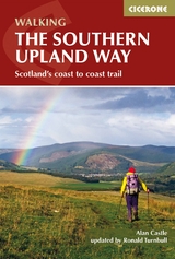
A guidebook to Scotland’s coast-to-coast walk, The Southern Upland Way. At 347 kms (215 miles), this is the longest of Scotland’s Great Trails, linking Portpatrick in the west to Cockburnspath in the east.
The route is presented in 14 stages of between 15 and 30 kms (9-19 miles) with an additional rest day suggested to explore Moffat. Crossing the high moorland of the Galloway Hills, Carsphairn range, Lowther and Ettrick Hills, the walk is a strenuous one, calling for competence, fitness, and self-reliance.
Clear route descriptions accompany 1:50,000 OS mapping
Trek planner with accommodation options to help you plan your trip
Includes advice on backpacking – taking advantage of five bothies and unlimited wild camping possibilities – or staying in accommodation (ideally reached via pre-arranged vehicle pick-up)
Notes on history, geography, and local sights
GPX files available to download
Alan Castle has trekked and cycled in over 30 countries and has written 18 guidebooks. He is a member of the Outdoor Writers and Photographers Guild. An erstwhile national secretary and long-distance path information officer of the Long Distance Walkers Association, Alan now lives at the foot of the Moffat Hills in Scotland. Ronald Turnbull writes regularly for TGO, Lakeland Walker, Trail and Cumbria magazines. He has written many other Cicerone guides, including Walking in the Lowther Hills, The Book of the Bivvy and Not the West Highland Way.
Map key
Overview map
Route summary table
Introduction
The Southern Upland Way
West to east or east to west?
When to go
Ways of tackling the SUW
Luggage transfer and drop-off/pick-up services
Accommodation
Getting to and from the SUW
Planning and preparation
Equipment
Maps
Waymarking and navigation
Access in Scotland
Ticks
Completion certificates and SUW badges
A high-level alternative coast-to-coast route
Using this guide
The route
Stage 1 Portpatrick to Castle Kennedy
Stage 2 Castle Kennedy to New Luce
Stage 3 New Luce to Bargrennan
Stage 4 Bargrennan to the Glenkens
Stage 5 Across the Glenkens
Stage 6 The Glenkens to Sanquhar
Stage 7 Sanquhar to Dalveen Pass
Stage 8 Dalveen Pass to Beattock (Moffat)
Rest day - Moffat and environs
Stage 9 Beattock (Moffat) to Ettrick
Stage 10 Ettrick to Traquair (Innerleithen)
Stage 11 Traquair (Innerleithen) to Melrose
Stage 12 Melrose to Lauder
Stage 13 Lauder across the Lammermuir Hills to Longformacus
Stage 14 Longformacus to Cockburnspath
Appendix A Itinerary planner
Appendix B Bothies along the SUW
Appendix C Bibliography
Appendix D Useful contacts
| Erscheinungsdatum | 27.07.2018 |
|---|---|
| Reihe/Serie | Cicerone guidebooks |
| Überarbeitung | Ronald Turnbull |
| Zusatzinfo | 15 maps + 70 colour photos |
| Verlagsort | Kendal |
| Sprache | englisch |
| Maße | 116 x 172 mm |
| Gewicht | 220 g |
| Themenwelt | Sachbuch/Ratgeber ► Sport |
| Reisen ► Sport- / Aktivreisen ► Europa | |
| ISBN-10 | 1-85284-993-2 / 1852849932 |
| ISBN-13 | 978-1-85284-993-1 / 9781852849931 |
| Zustand | Neuware |
| Haben Sie eine Frage zum Produkt? |
aus dem Bereich