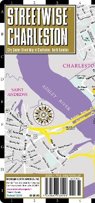
Streetwise Charleston Map - Laminated City Center Street Map of Charleston, South Carolina
City Plans
Seiten
2018
Michelin Editions des Voyages (Verlag)
978-2-06-723011-8 (ISBN)
Michelin Editions des Voyages (Verlag)
978-2-06-723011-8 (ISBN)
- Titel ist leider vergriffen;
keine Neuauflage - Artikel merken
Michelin City Plans come in practical formats, paper, laminated and accordian folds. Suited for tourist use and with clear precise mapping. Starting at 1/8000 scale and upwards
REVISED 2018
Streetwise Charleston Map is a laminated city center map of Charleston, South Carolina in an accordion-fold pocket size format. A complete index of streets, hotels, points of interest, shopping, education, culture, and parks is clearly listed.
Coverage includes:
Main Charleston, South Carolina Map 1:19,000
Historic Charleston Map 1:9,500
Charleston Regional Map 1;780,000
Charleston Area Map 1:220,000
North Charleston Map 1:39,000.
Dimensions: 4" x 8.5" folded, 8.5" x 24" unfolded
Charleston is where history lives. Some areas still reflect the three hundred year old history of this coastal city. For example, Charleston’s Historic District encompasses over 2000 historic buildings. The surrounding areas contain old plantation homes, some active today. The STREETWISE® map of Charleston, SC will enable you to experience the rich history and culture of this quintessential Southern city. Our detailed Historic Charleston inset map identifies all the important historic homes and buildings which you will want to see during your walking tour.
The main city center map of Charleston helps you navigate into and out of the city center. It also expands on the number of sites featured including hotels, shopping, educational institutions and neighborhoods. The Charleston map's backside features two additional maps: the Charleston Regional Map covers the geography between Savannah, Georgia and Charleston, South Carolina. The Charleston Area Map helps to navigate around the perimeter of the city to such notable places as The Boone Plantation, Drayton Hall and the Charleston International Airport. A complete index of streets, hotels, points of interest, shopping, education, culture, and parks is clearly listed.
Our pocket size map of Charleston is laminated for durability and accordion folding for effortless use. To enhance your visit to Charleston, check out the Michelin Must Sees Charleston or Michelin Charleston Short Stays travel guides which details the must do's, sees, stay, eat and know using the famed Michelin star-rating system so you can prioritize your trip based on your own time and interest.
| Erscheint lt. Verlag | 15.4.2018 |
|---|---|
| Reihe/Serie | Michelin City Plans |
| Verlagsort | Paris |
| Sprache | englisch |
| Maße | 102 x 220 mm |
| Gewicht | 100 g |
| Themenwelt | Reisen ► Karten / Stadtpläne / Atlanten ► Nord- / Mittelamerika |
| Reiseführer ► Nord- / Mittelamerika ► USA | |
| ISBN-10 | 2-06-723011-5 / 2067230115 |
| ISBN-13 | 978-2-06-723011-8 / 9782067230118 |
| Zustand | Neuware |
| Haben Sie eine Frage zum Produkt? |
Mehr entdecken
aus dem Bereich
aus dem Bereich
Karte (gefalzt) (2024)
Michelin Editions des Voyages (Verlag)
11,95 €
Map
Karte (gefalzt) (2024)
Michelin Editions des Voyages (Verlag)
19,95 €


