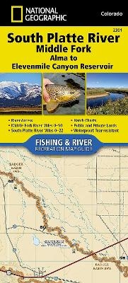
South Platte River - Middle Fork, Alma To Elevenmile Canyon
Seiten
2017
|
2017th ed.
National Geographic Maps (Verlag)
978-1-56695-701-4 (ISBN)
National Geographic Maps (Verlag)
978-1-56695-701-4 (ISBN)
- Keine Verlagsinformationen verfügbar
- Artikel merken
Waterproof, Tear-Resistant Fishing & River Map. The South Platte River - Middle Fork, Alma to Elevenmile Canyon Reservoir Fishing & River Map Guide is designed to be the perfect companion to anyone recreating on the upper reaches of the Middle Fork of the South Platte. In the upper reaches of the South Platte basin, the Middle and South Fork (above Antero) are classic freestone streams (with beaver ponds) that are consistently inconsistent with regard to flow, water temperature, clarity, hatches, and many other variables such as freezing up during the winter months. In comparison, the tailraces (i.e. below Antero and Spinney Mountain Reservoir) are much more predictable, providing anglers with a consistent year-round fishery. This Fishing & River Map Guide includes the area between Spinney Mountain and Elevenmile Reservoirs known as the 'Dream Stream', known for producing some of the biggest trout in the country. Each Fishing & River Map Guide includes detailed river maps at a scale o
| Erscheint lt. Verlag | 15.10.2017 |
|---|---|
| Verlagsort | Evergreen |
| Sprache | englisch |
| Maße | 110 x 240 mm |
| Themenwelt | Reisen ► Karten / Stadtpläne / Atlanten ► Nord- / Mittelamerika |
| Reiseführer ► Nord- / Mittelamerika ► USA | |
| ISBN-10 | 1-56695-701-X / 156695701X |
| ISBN-13 | 978-1-56695-701-4 / 9781566957014 |
| Zustand | Neuware |
| Haben Sie eine Frage zum Produkt? |
Mehr entdecken
aus dem Bereich
aus dem Bereich
Karte (gefalzt) (2024)
Michelin Editions des Voyages (Verlag)
11,95 €
Map
Karte (gefalzt) (2024)
Michelin Editions des Voyages (Verlag)
19,95 €


