Wales
1997
Automobile Association (Verlag)
978-0-7495-1550-8 (ISBN)
Automobile Association (Verlag)
978-0-7495-1550-8 (ISBN)
- Keine Verlagsinformationen verfügbar
- Artikel merken
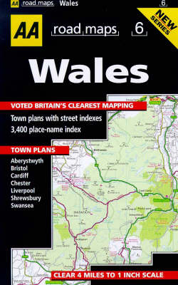
A road map of Wales at a scale of four miles to one inch, with an index of 3400 place-names and seven street-indexed town plans. Also featured are recommended through-routes, one-way streets, car parks and places of interest.
| Erscheint lt. Verlag | 19.5.1997 |
|---|---|
| Reihe/Serie | AA Road Maps ; No. 6 |
| Zusatzinfo | 7 town plans, indexes |
| Verlagsort | Basingstoke |
| Sprache | englisch |
| Maße | 159 x 241 mm |
| Gewicht | 108 g |
| Themenwelt | Reisen ► Karten / Stadtpläne / Atlanten ► Europa |
| Reiseführer ► Europa ► Großbritannien | |
| ISBN-10 | 0-7495-1550-3 / 0749515503 |
| ISBN-13 | 978-0-7495-1550-8 / 9780749515508 |
| Zustand | Neuware |
| Haben Sie eine Frage zum Produkt? |
Mehr entdecken
aus dem Bereich
aus dem Bereich
Karte (gefalzt) (2023)
Michelin Editions des Voyages (Verlag)
11,95 €


