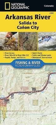
Arkansas River, Salida To Canon City
Seiten
2017
|
2017th ed.
National Geographic Maps (Verlag)
978-1-56695-704-5 (ISBN)
National Geographic Maps (Verlag)
978-1-56695-704-5 (ISBN)
- Keine Verlagsinformationen verfügbar
- Artikel merken
Waterproof, Tear-Resistant Fishing & River Map. The Arkansas River, Salida to Canon City Fishing & River Map Guide is designed to be the perfect companion to anyone recreating on this section of the Arkansas. From Salida to Canon City, the Arkansas River cuts east through a series of high desert canyons collectively known as Bighorn Sheep Canyon and the Royal Gorge. Along the way, it covers 56 river miles and drops 1,700 feet in elevation. The geology of this reach varies greatly, with canyons confining the channel from Salida to Howard, Coaldale to Lone Pine, and Texas Creek to Parkdale. Between these, the terrain opens up, with the river typically becoming broader and the current velocity less. The final stretch, the Royal Gorge, is a Class IV+ chasm that is only accessible by boat and is not known for its fishing. Each Fishing & River Map Guide includes detailed river maps at a scale of 1 inch to 1/2 mile. At this scale every turn in the river and rapid is clearly shown and labeled
| Erscheint lt. Verlag | 7.6.2017 |
|---|---|
| Verlagsort | Evergreen |
| Sprache | englisch |
| Maße | 110 x 240 mm |
| Themenwelt | Reisen ► Karten / Stadtpläne / Atlanten ► Nord- / Mittelamerika |
| Reiseführer ► Nord- / Mittelamerika ► USA | |
| ISBN-10 | 1-56695-704-4 / 1566957044 |
| ISBN-13 | 978-1-56695-704-5 / 9781566957045 |
| Zustand | Neuware |
| Haben Sie eine Frage zum Produkt? |
Mehr entdecken
aus dem Bereich
aus dem Bereich
Karte (gefalzt) (2024)
Michelin Editions des Voyages (Verlag)
11,95 €
Map
Karte (gefalzt) (2024)
Michelin Editions des Voyages (Verlag)
19,95 €


