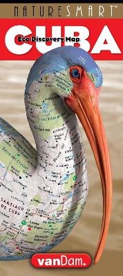
Naturesmart Cuba Map by Vandam
Country Road & Eco Travel Map of Cuba
2017
StreetSmart Maps (Verlag)
978-1-934395-57-8 (ISBN)
StreetSmart Maps (Verlag)
978-1-934395-57-8 (ISBN)
- Titel nicht im Sortiment
- Artikel merken
NatureSmartCuba by VanDam maps all of Cuba’s natural and cultural attractions including beach resorts, ecotourism spots, diving and birding destinations, national parks as well as Havana’s cultural attractions with museums, major architecture, hotels , restaurants and music venues all clearly marked at an immensely legible scale. Clear information design allows users to read the map from three feet away and has earned vanDam maps inclusion in the MoMA Collection. The map is laminated and accordion folded and easily fits into your shirt pocket or purse. Dimensions: open 9” x 32” (closed 9” x 4”).
Contents: Cuba Country driving map scale: 1:1,100,000 Havana Vieja Detail map scale: 1:5,500 Endemic Species key and pictures; Reef map details with Diving spots;
Remember web access in Cuba is limited to hotels, excruciatingly slow and up-to-date information simply unavailable. There are no maps to buy once you get there. Even if you booked a tour and are ready to follow the person in front of you NatureSmartCuba makes you understand how all the parts of Cuba connect geographically, culturally and ecologically. So you have more stories to tell once back home.
NatureSmartCuba by VanDam Its Havana Vieja map shows all major sites architectural and cultural sites with recommended Malecón, Museum and Music Club guided walks to get you around town with confidence and the latest information. A brief riff of how Havana music and architecture are part of the same rhythmic energy will add to your insights.
NatureSmartCuba by VanDam covers the entire country from the western Pinar del Río and its endemic —Cuba only —snails in Valle de Viñales to the trails and special birding sites in Zapata National Park opposite the Bay of Pigs — Museo Girón— best combined with a trip to the architectural jewel that is Trinidad. From the northern beach resorts of Cayo Coco and Varadero to the special reef diving spots in the Jardines de la Reina National Park in the Caribbean Sea, from the mountains of the Sierra Maestra to the wet, humid rainforests of Parque Nacional de Alejandro de Humboldt in the Eastern province of Guantanamo you will see and understand why Cuba is called the Galapagos of the Caribbean. In addition to visualizing unique animal species found nowhere else the map abounds with practical information including critical gas stations for a cross country car trip.
Cuba maps by VanDamare updated twice a year and most current. Its film lamination is extra durable and will last for your next trip. Simplicity reigns supreme to make complex cities clear and understandable. Our typography creates character and reveals the true bones of the city. Each map opens to 32" x 9" and then folds down to 4"x 9". Buy this map to become an instant StreetSmart Cubana and gain instant Cuba SMARTS…!
| Erscheinungsdatum | 04.07.2017 |
|---|---|
| Reihe/Serie | Naturesmart |
| Sprache | englisch |
| Themenwelt | Reisen ► Karten / Stadtpläne / Atlanten ► Nord- / Mittelamerika |
| Reiseführer ► Nord- / Mittelamerika ► Karibik | |
| ISBN-10 | 1-934395-57-9 / 1934395579 |
| ISBN-13 | 978-1-934395-57-8 / 9781934395578 |
| Zustand | Neuware |
| Informationen gemäß Produktsicherheitsverordnung (GPSR) | |
| Haben Sie eine Frage zum Produkt? |
Mehr entdecken
aus dem Bereich
aus dem Bereich
Barbados, Trinidad & Tobago, Windward Island, Französische & …
Buch | Softcover (2024)
MAIRDUMONT (Verlag)
15,95 €


