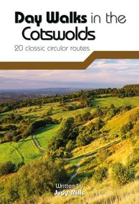
Day Walks in the Cotswolds
Vertebrate Publishing Ltd (Verlag)
978-1-910240-99-1 (ISBN)
Day Walks in the Cotswolds features 20 circular routes, between 7.1 and 12.6 miles (11.5km and 20.2km), suitable for hillwalkers of all abilities. Split across three areas – North-East Cotswolds, North-West Cotswolds and South Cotswolds – local author Judy Mills shares her favourite walks in this Area of Outstanding Natural Beauty.
These walks take in a variety of local landmarks, including the World War II airfield and Roman villa at Chedworth; Neolithic long barrows such as Hetty Pegler’s Tump; grand country estates like Badminton; magnificent Cotswold manor houses and historic churches; high points at Bredon Hill and North Nibley; and the many charming rural villages, such as the Duntisbournes and the Slaughters, for which the Cotswolds are famous.
Each route features Ordnance Survey 1:25,000 maps, easy-to-follow directions, details of distance and navigation information, and refreshment stops and local information. The walks are illustrated with stunning photography by outdoor photographer Adam Long.
Judy Mills’ love for the English countryside grew when she moved to a small Somerset village at the age of nine. After studying ecology at university, she found that jobs where she could sit in a field counting flowers were hard to come by, so spent thirty years in the police service, leading voluntary working holidays with the National Trust in her spare time. A keen but slow runner she completes a couple of marathons each year as well as taking part in the annual Cotswold Way Relay. She enjoys walking and horse riding, and in 2014 cycled from Land’s End to John o’Groats. She lives with her husband in Gloucestershire where they keep sheep and beef shorthorn cattle.
Introduction
Acknowledgements
About
the walks
Walk
times
Navigation
GPS
and mobile phones
Parking
Rights
of way
Safety
The
Countryside Code
Dogs
Farmland
Other
users of the countryside
The
Cotswold Way
How
to use this book
Maps,
descriptions, distances
Km/mile
conversion chart
Cotswolds Area Map
Section
1 – The North-East Cotswolds
1
Southrop & the Eastleaches
2
The Windrush at Windrush
3
Bledington Morris
4
Five Churches
5
Naunton & the Slaughters
6
Broadway & Snowshill
7
Rollright & Adlestrop
Section
2 – The North-West Cotswolds
8
Bredon Hill
9
Chedworth
10
Sapperton Tunnels
11
Slad & the Painswick Brook
12
Winstone & the Duntisbournes
13
Brimpsfield & Birdlip
14
Belas Knap & the Beesmoor Brook
Section
3 – The South Cotswolds
15
Lasborough & Ozleworth Bottom
16
Wotton-under-Edge & North Nibley
17
Dyrham & West Littleton
18
St Catherine’s Court & Little Solsbury Hill
19
Owlpen & Hetty Pegler’s Tump
20
Badminton
Appendix
| Erscheinungsdatum | 30.06.2017 |
|---|---|
| Reihe/Serie | Day Walks |
| Illustrationen | Adam Long |
| Zusatzinfo | Ordnance Survey 1:25,000 scale maps; Colour photographs |
| Sprache | englisch |
| Maße | 120 x 175 mm |
| Gewicht | 210 g |
| Themenwelt | Sachbuch/Ratgeber ► Sport |
| Reiseführer ► Europa ► Großbritannien | |
| ISBN-10 | 1-910240-99-0 / 1910240990 |
| ISBN-13 | 978-1-910240-99-1 / 9781910240991 |
| Zustand | Neuware |
| Haben Sie eine Frage zum Produkt? |
aus dem Bereich


