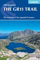
The GR11 Trail
Cicerone Press (Verlag)
978-1-85284-921-4 (ISBN)
- Titel ist leider vergriffen;
keine Neuauflage - Artikel merken

The GR11 trail (La Senda Pirenaica) is a glorious 820km traverse of the Pyrenees from the Atlantic to the Mediterranean on the Spanish side of the border with France.
The guidebook presents the route in 47 stages of 8-31km and provides everything hikers will need to take up the challenge - detailed route description, excellent photographs, lots of background information and unique custom-produced maps. Also included are bad weather options - although the weather is often good along this route - detours to find accommodation at some points, and advice on where to stay, supplies, language and logistics, as well as a glossary including Aragon, Basque and Catalan words, to help you find your way.
Although it's a serious challenge for experienced walkers the route is less demanding than the higher-level Pyrenean Haute Route, sunnier and wilder than the GR10 which runs along the French side, and well waymarked throughout with regular opportunities to find accommodation and stock up your supplies.
Since taking early retirement from his career as a physics and sports teacher, Brian Johnson has found time for three thru-hikes of the Pacific Crest Trail, a 2700-mile round-Britain walk and a single summer compleation of the Munros. A keen climber and hiker, he has led school groups in Britain, the Alps, the Pyrenees and California and has completed ten traverses from Atlantic to Mediterranean on the Pyrenean Haute Route, GR11 or GR10.
Map key
Overview map
Publisher's dedication
Author's preface
Introduction
National and natural parks
From the Atlantic to the Mediterranean
The GR11
Weather and when to go
Wildlife
Getting to the start
Getting home
Equipment
Culture and language
Accommodation
Camping
Water
Using this guide
The GR11
Getting to Cabo de Higuer from Irún
Stage 1 Cabo de Higuer to Bera (Vera de Bidosoa)
Stage 2 Bera to Elizondo
Stage 3 Elizondo to Puerto de Urkiago
Stage 4 Puerto de Urkiago to Burguete (Auritz)
Stage 5 Burguete to Hiriberri (Villanueva de Aezkoa)
Stage 6 Hiriberri to Ochagavía (Otsagabia)
Stage 7 Ochagavía to Isaba (Izaba)
Stage 8 Isaba to Zuriza (over Peña Ezkaurri, GR11-4)
Stage 9 Zuriza to La Mina
Stage 9A Zuriza to Hotel Usón (Puen de Santana) (GR11-1)
Stage 10 La Mina to Refugio de Lizara (GR11)
Stage 10A Hotel Usón to Refugio de Lizara (GR11-1)
Stage 11 Refugio de Lizara to Candanchú
Stage 12 Candanchú to Sallent de G&##xe1;llego (Sall&##xe9;n de Galligo)
Stage 13 Sallent de G&##xe1;llego to Refugio de Respomuso
Stage 14 Refugio de Respomuso to Baños de Panticosa
Stage 15 Baños de Panticosa to San Nicol&##xe1;s de Bujaruelo (Buxargüelo)
Stage 16 San Nicol&##xe1;s de Bujaruelo to Refugio de Góriz
Stage 17 Refugio de Góriz to Refugio de Pineta
Stage 18 Refugio de Pineta to Parz&##xe1;n
Stage 19 Parz&##xe1;n to Refugio de Biadós (Viadós)
Stage 20 Refugio de Biadós to Puen de San Chaime (Puente de San Jaime)
Stage 21 Puen de San Chaime to Refugio de Cap de Llauset
Stage 22 Refugio de Cap de Llauset to Refugi de Conangles
Stage 23 Refugi de Conangles to Refugi dera Restanca
Stage 24 Refugi dera Restanca to Refugi de Colom&##xe8;rs (by Port de Caldes, GR11-18) Stage 25 Refugi de Colom&##xe8;rs to Espot
Stage 26 Espot to La Guingueta d'Àneu
Stage 27 La Guingueta d'Àneu to Estaon
Stage 28 Estaon to Tavascan
Stage 29 Tavascan to Àreu
Stage 30 Àreu to Refugi de Vallferrera
Stage 31 Refugi de Vallferrera to Refugi de Comapedrosa
Stage 32 Refugi de Comapedrosa to Arans
Stage 33 Arans to Encamp
Stage 34 Encamp to Refugio de l'Illa
Stage 35 Refugio de l'Illa to Refugi de Malniu
Stage 36 Refugi de Malniu to Puigcerd&##xe0;
Stage 37 Puigcerd&##xe0; to Camping Can Fosses, Planoles
Stage 38 Camping Can Fosses, Planoles to Núria
Stage 39 Núria to Setcases
Stage 40 Setcases to Beget
Stage 41 Beget to Sant Aniol d'Aguja
Stage 42 Sant Aniol d'Aguja to Albany&##xe0;
Stage 43 Albany&##xe0; to Maçanet de Cabrenys
Stage 44 Maçanet de Cabrenys to La Jonquera
Stage 45 La Jonquera to Els Vilars
Stage 46 Els Vilars to Llanç&##xe0;
Stage 47 Llanç&##xe0; to Cap de Creus
Appendix A Route summary table
Appendix B Facilities table
Appendix C Glossary
Appendix D Sources of information
| Erscheinungsdatum | 28.04.2018 |
|---|---|
| Reihe/Serie | Cicerone guidebooks |
| Zusatzinfo | Over 50 maps and 150 photos |
| Verlagsort | Kendal |
| Sprache | englisch |
| Maße | 116 x 172 mm |
| Gewicht | 320 g |
| Themenwelt | Sachbuch/Ratgeber ► Sport |
| Reiseführer ► Europa ► Spanien | |
| Reisen ► Sport- / Aktivreisen ► Europa | |
| ISBN-10 | 1-85284-921-5 / 1852849215 |
| ISBN-13 | 978-1-85284-921-4 / 9781852849214 |
| Zustand | Neuware |
| Informationen gemäß Produktsicherheitsverordnung (GPSR) | |
| Haben Sie eine Frage zum Produkt? |
aus dem Bereich