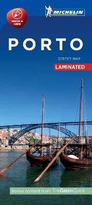
Porto - Michelin City Map 9212
Laminated City Plan
Seiten
2017
Michelin Editions des Voyages (Verlag)
978-2-06-722390-5 (ISBN)
Michelin Editions des Voyages (Verlag)
978-2-06-722390-5 (ISBN)
- Titel erscheint in neuer Auflage
- Artikel merken
Zu diesem Artikel existiert eine Nachauflage
Michelin City Plans come in practical formats, paper, laminated and accordian folds. Suited for tourist use and with clear precise mapping. Starting at 1/8000 scale and upwards
Discover Porto by foot, car or bike using Michelin Porto City Plan (scale 1/12,500 cm). In addition to Michelin's clear and accurate mapping, this city plan will help you explore and navigate across Porto's different districts thanks to its full index, its comprehensive key showing places of interest and tourist attractions, as well as practical information on public transport leisure facilities, service stations and shops!
Discover the new range of Michelin City Maps
* Write on Wipe off ,Draw your route with a felt tipped pen, Erase with a damp cloth!
* Plastic Format
* Durable and convenient to use
* Handy Compact, folds "free" for easy handling
* Clarity and legibility of Michelin mapping:
* Map of the city centre with identified tourist sites
* Green Guide tourist sites
* Smaller Map of whole city
* Underground Map, with a detailed index
| Erscheint lt. Verlag | 31.5.2017 |
|---|---|
| Verlagsort | Paris |
| Sprache | englisch |
| Maße | 113 x 250 mm |
| Gewicht | 118 g |
| Themenwelt | Reisen ► Karten / Stadtpläne / Atlanten ► Europa |
| ISBN-10 | 2-06-722390-9 / 2067223909 |
| ISBN-13 | 978-2-06-722390-5 / 9782067223905 |
| Zustand | Neuware |
| Haben Sie eine Frage zum Produkt? |
Mehr entdecken
aus dem Bereich
aus dem Bereich
Straßen- und Freizeitkarte 1:250.000
Karte (gefalzt) (2023)
Freytag-Berndt und ARTARIA (Verlag)
12,90 €
Karte (gefalzt) (2023)
Freytag-Berndt und ARTARIA (Verlag)
12,90 €
Östersund
Karte (gefalzt) (2023)
Freytag-Berndt und ARTARIA (Verlag)
12,90 €


