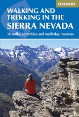
Walking and Trekking in the Sierra Nevada
Cicerone Press (Verlag)
978-1-85284-917-7 (ISBN)
A guidebook to 30 day walks and 2-day excursions, 5 high mountain scrambles and three longer multi-day routes in Spain’s Sierra Nevada. Routes are graded by difficulty: all call for good fitness and hillwalking experience, and the more demanding options involve navigational challenge, prolonged ascents, remote rugged mountain terrain and scrambling.
The walks range from 5 to 38km (3–24 miles) and from 3 hours to 2–3 days. The scrambles are graded from Grade 2 to 3S. Also included are a 3–7 day traverse of the range’s 3000m peaks, a 3-day traverse of the 3 highest peaks ('Los Tres Picos') and an overview of the 302km (188 mile) Sulayr GR240.
Clear route description illustrated with 1:50,000 mapping (1:100,000 and 1:250,000 for the longer treks)
Photo topos showing the line of the scrambles
GPX files available for download
Information on water sources, plus additional notes for winter mountaineers
Includes ascents of Mulhacén, mainland Spain’s highest summit
Richard Hartley has lived in Lanjarón in the Sierra Nevada since 2002. He is the owner of a local company which runs mountaineering, snowshoeing and ski-touring trips in the Sierra Nevada and, further afield, organize regular expeditions to the Southern Patagonian Icecap.
Overview map
Mulhac&##xe9;n and Alcazaba overview map
Map key
Mountain safety
Route summary tables
Introduction
Plants and wildlife
Climate and conditions
Getting to the Sierra Nevada
Getting around
Accommodation and bases
Respecting the environment
Safety and rescue
Water sources
Weather resources
Planning and maps
Using this guide
Walks
Trev&##xe9;lez
Route 1 Ascent of Alcazaba via Cañada de Siete Lagunas
Route 2 Ascent of Mulhac&##xe9;n via Cañada de Siete Lagunas
Route 3 Round of the Río Juntillas and Trev&##xe9;lez valleys
Capileira
Route 4 Barranco de Poqueira circular
Route 5 Ascent of Mulhac&##xe9;n from Hoya del Portillo
Refugio Poqueira
Route 6 Ascent of Mulhac&##xe9;n from Refugio Poqueira
Route 7 The Caldera peaks
Route 8 Around Mulhac&##xe9;n via the Vasar and Siete Lagunas
Route 9 The Púlpitos
Western Alpujarras
Route 10 Pico del Tajo de los Machos and Cerrillo Redondo
Route 11 Ascent of Cerro del Caballo from the south
Route 12 Ascent of Cerro del Caballo via los Tres Mojones
Dílar valley
Route 13 Silleta de Padul
Route 14 Integral de los Alayos
Cumbres Verdes
Route 15 Boca de la Pesca
Route 16 Trevenque via Cuerda del Trevenque
Route 17 Circuit of Trevenque and Dílar valley
Route 18 The Cerro Huenes group
Route 19 Pico del Tesoro and Cerro del Cocón
Route 20 Trevenque direct
Ski area - Hoya de la Mora
Route 21 Veleta, Tajos de la Virgen and Lagunillas
Route 22 Veredón Superior and Cerro de los Machos
Route 23 Veredón Inferior, Veta Grande, northern flanks and lakes
Route 24 Across the mountains to Lanjarón via Refugio Elorrieta
Vereda de la Estrella/Genil valley
Route 25 Vereda de la Estrella, Refugio Cucaracha and Cueva Secreta
Route 26 Cortijos del Hornillo circular
Route 27 Ascent of Mulhac&##xe9;n via Cueva Secreta
Route 28 Round of the northern peaks via Peña Partida
J&##xe9;rez del Marquesado and Refugio Postero Alto
Route 29 Ascent of Picón de J&##xe9;rez and round of the Alhorí valley
Puerto de la Ragua
Route 30 The eastern peaks
Main ridge traverse and longer treks
Route 31 ‘Los Tres Miles' Integral 3000m peaks
Route 32 ‘Los Tres Picos' - Veleta, Mulhac&##xe9;n and Alcazaba
Route 33 The Sulayr GR240
High mountain scrambles
Route 34 Espolón de Alcazaba
Route 35 Traverse of Puntal de la Caldera
Route 36 Espolón de la Caldera
Route 37 Arista de las Campanitas
Route 38 North ridge of Tozal del Cartujo
Appendix A List of the 3000m peaks
Appendix B Accommodation
Appendix C Useful contacts
Appendix D Glossary
Appendix E Further reading
| Erscheinungsdatum | 26.11.2017 |
|---|---|
| Reihe/Serie | Cicerone guidebooks |
| Zusatzinfo | 39 maps, 98 colour photos |
| Verlagsort | Kendal |
| Sprache | englisch |
| Maße | 116 x 172 mm |
| Gewicht | 310 g |
| Themenwelt | Sachbuch/Ratgeber ► Sport |
| Reiseführer ► Europa ► Spanien | |
| Reisen ► Sport- / Aktivreisen ► Europa | |
| ISBN-10 | 1-85284-917-7 / 1852849177 |
| ISBN-13 | 978-1-85284-917-7 / 9781852849177 |
| Zustand | Neuware |
| Haben Sie eine Frage zum Produkt? |
aus dem Bereich