North Downs Way Map Booklet
Cicerone Press (Verlag)
978-1-85284-955-9 (ISBN)
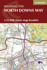
A booklet of all the mapping needed to complete the North Downs Way National Trail between the high downland of Farnham, Hampshire and Dover on the Kent coast. Covering 208km (130 miles), this gentle trail takes around 11 days to walk and is an ideal first long-distance hike for beginners.
The full route line is shown on 1:25,000 OS maps
The map booklet can be used to walk the trail in either direction
Sized to easily fit in a jacket pocket
The relevant extract from the OS Explorer map legend is included
3-stage route detour via Canterbury is also provided
An accompanying Cicerone guidebook – Walking the North Downs Way – is also available, which includes a copy of this map booklet
A lifelong passion for the countryside in general, and mountains in particular, drove Kev's desire to share his sense of wonder and delight in the natural world through his writing, guiding, photography and lecturing. Spending several months every year in various high-mountain regions researching guidebooks made him The Man with the World's Best Job. Kev enjoyed a fruitful partnership with Cicerone from the 1970s, producing 50 books, including guides to five major trekking regions of Nepal and to numerous routes in the European Alps and Pyrenees, as well as walking guides for Kent, Sussex and the Cotswolds. 'A Walk in the Clouds' is a collection of autobiographical short stories recording 50 years of mountain travel and adventures. He was also the contributing editor of the collaborative guide 'Trekking in the Himalaya' and Cicerone's celebratory anniversary compilation 'Fifty Years of Adventure'. A frequent contributor to outdoor magazines, Kev also wrote and illustrated brochures for national tourist authorities and travel companies. When not away in the mountains, Kev lived with his wife in a small cottage among what he called 'the Kentish Alps', with unrestricted walking country on the doorstep. But he also travelled throughout Britain during the winter months to share his love of the places he wrote about through a series of lectures. Sadly, Kev passed away in 2021. He will be remembered fondly by all who knew him and by many more he inspired through his writing and talks.
| Erscheinungsdatum | 30.07.2017 |
|---|---|
| Reihe/Serie | Cicerone guidebooks |
| Verlagsort | Kendal |
| Sprache | englisch |
| Maße | 116 x 172 mm |
| Gewicht | 110 g |
| Themenwelt | Sachbuch/Ratgeber ► Sport |
| Reisen ► Karten / Stadtpläne / Atlanten ► Europa | |
| Reiseführer ► Europa ► Großbritannien | |
| ISBN-10 | 1-85284-955-X / 185284955X |
| ISBN-13 | 978-1-85284-955-9 / 9781852849559 |
| Zustand | Neuware |
| Haben Sie eine Frage zum Produkt? |
aus dem Bereich