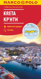
MARCO POLO Karte Kreta 1:150 000
MAIRDUMONT (Verlag)
978-3-8297-3972-6 (ISBN)
- Titel ist leider vergriffen;
keine Neuauflage - Artikel merken
Es ist gut zu wissen, wo sich im Urlaubsgebiet die bedeutenden kulturellen und landschaftlichen Sehenswürdigkeiten befinden. Das präzise und klar lesbare Kartenbild der MARCO POLO Karte führt Sie nicht nur zu diesen wirklich interessanten Stellen, sondern zeigt Ihnen außerdem noch viele andere wissenswerte Details. Dank des großen Maßstabs 1:150 000 können Sie sich gut in der fremden Landschaft orientieren und finden auch auf interessanten, abgelegenen Straßen sicher zum Ziel.
lt;p>Marco Polo was the original, trailblazing 'tourist'. Born around 1254 into a wealthy Venetian merchant family, at the age of 17 he embarked on an epic journey to Asia and was one of the first westerners to visit China. When he returned he recorded his extensive travels by publishing a book which introduced Europeans to Central Asia and China, possibly the first 'travel guide' ever published!
Marco Polo's travels have since inspired countless adventurers to set off and see the world. It is reputed that Christopher Columbus set off across the Atlantic with a copy of Marco Polo's original book. It is this pioneering spirit that drives us at Marco Polo Travel Publishing to provide the best guides, maps, atlases, and phrasebooks to help you explore the world. We hope our guides and maps will inspire you to set off on your own adventures.
Pocket Guides
Compact, colourful guides packed with Insider Tips
Spiral Guides
Itinerary-based guides in a unique, lay-flat spiral bound format
Travel Handbooks
Visually inspiring, comprehensive guides offering detailed advice and informative infographics
Folded Maps
High quality touring maps with innovative Zoom system
City & Holiday Maps
Compact, laminated maps with a detailed scale and maximum coverage
marcopologuides.com
Hauptkarte im Maßstab 1:150 000/ Übersichtskarte zum Ausklappen/ Entfernungstabelle/ Index: mehrsprachige Legende (D, GB, F, GR, I, E, CZ, PL) Marco Polo Highlights/ 4 Citypläne: - Ágios Nikólaos - Haniá - Iraklio - Réthimno Wichtige Verkehrsinformationen Griechenlands/ Verkehrsinformationen/ Ortsregister mit Distrikt und Suchfeldangabe Ausgewählte Sehenswürdigkeiten, Landschafts- und Gewässernamen mit Suchfeldangabe
| Erscheint lt. Verlag | 24.7.2018 |
|---|---|
| Reihe/Serie | MARCO POLO Karten 1:200.000 |
| Verlagsort | Ostfildern |
| Sprache | deutsch |
| Maße | 130 x 250 mm |
| Gewicht | 142 g |
| Themenwelt | Reisen ► Karten / Stadtpläne / Atlanten ► Europa |
| Schlagworte | Abenteuer Reisen • Antike Fundstellen • Crete, Agios Nikolaos, Hania, Heraklion, Iraklio, Rethymno, Maro polo, travel guide, map, OS maps, O • Inselplan • Knossos • Kreta, Karte; Autokarte/Straßenkarte • Kritsa • Mittelmeer • Oliven • Panagia Kera • Reiseführer • Reisetipps • Samaria-Schlucht • Sonne • Spinalonga • Strand • Strandurlaub • Urlaub |
| ISBN-10 | 3-8297-3972-9 / 3829739729 |
| ISBN-13 | 978-3-8297-3972-6 / 9783829739726 |
| Zustand | Neuware |
| Informationen gemäß Produktsicherheitsverordnung (GPSR) | |
| Haben Sie eine Frage zum Produkt? |
aus dem Bereich