The Pennine Way
Cicerone Press (Verlag)
978-1-85284-906-1 (ISBN)
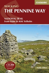
A guidebook to walking the Pennine Way, England’s toughest National Trail. Suited to fit experienced walkers, the 427km (265 mile) route from Edale to Kirk Yetholm follows northern England’s mountainous spine, passing through three national parks: the Peak District, the Yorkshire Dales and Northumberland.
The route is described from south to north in 20 stages of between 11 and 32km (7–20 miles).
Contains step-by-step description of the route alongside 1:100,000 maps and elevation profiles
Includes a separate map booklet containing OS 1:25,000 mapping with the route line
Route summary table and trek planner showing the distribution of facilities and public transport along the route
Accommodation listings
GPX files available for free download
Paddy Dillon is a prolific outdoor writer with over 70 guidebooks to his name, and contributions to 30 other publications. He has written for a variety of outdoor magazines, as well as many booklets and brochures for tourism organisations. Paddy lives near the Lake District and has walked in every county in England, Scotland, Ireland and Wales; writing about walks in every one of them. He enjoys simple day walks, challenging long-distance walks, and is a dedicated island-hopper. He has led guided walks and walked extensively in Europe, as well as in Nepal, Tibet, Korea, Africa and the Rocky Mountains of Canada and the United States.
Map key
Route summary table
Overview map
Profile
Trek planner
Preface
Introduction
Wanted: A Long Green Trail
Planning your trip
Choosing an itinerary
When to walk
Travel to and from the Pennine Way
Travel along the Pennine Way
First and last nights
Accommodation
Food and drink
Baggage transfer
What to take
Money
Planning day to day
Using this guide
Additional mapping
Waymarking and access
Weather forecasts
Phones and Wi-Fi
Emergencies
All about the Pennines
Pennine geology
Pennine scenery
The Helm Wind
Wildlife
Plant life
The Pennine Way
Day 1 Edale to Torside
Day 2 Torside to Standedge
Day 3 Standedge to Callis Bridge or Hebden Bridge
Day 4 Callis Bridge or Hebden Bridge to Ickornshaw
Day 5 Ickornshaw to Gargrave
Day 6 Gargrave to Malham
Day 7 Malham to Horton in Ribblesdale
Day 8 Horton in Ribblesdale to Hawes
Day 9 Hawes to Keld
Day 10 Keld to Baldersdale or Bowes
Day 11 Baldersdale or Bowes to Middleton-in-Teesdale
Day 12 Middleton-in-Teesdale to Langdon Beck
Day 13 Langdon Beck to Dufton
Day 14 Dufton to Alston
Day 15 Alston to Greenhead
Day 16 Greenhead to Housesteads
Day 17 Housesteads to Bellingham
Day 18 Bellingham to Byrness
Day 19 Byrness to Clennell Street
Day 20 Clennell Street to Kirk Yetholm
Appendix A Useful contacts
Appendix B Accommodation list
Appendix C Further reading
| Erscheinungsdatum | 12.03.2017 |
|---|---|
| Reihe/Serie | Cicerone guidebooks |
| Zusatzinfo | 85 colour photos, 21 maps, 21 profiles map booklet: 120 pages of OS 1:25K mapping + map legend |
| Verlagsort | Kendal |
| Sprache | englisch |
| Maße | 116 x 172 mm |
| Gewicht | 440 g |
| Themenwelt | Sachbuch/Ratgeber ► Sport |
| Reiseführer ► Europa ► Großbritannien | |
| Reisen ► Sport- / Aktivreisen ► Europa | |
| ISBN-10 | 1-85284-906-1 / 1852849061 |
| ISBN-13 | 978-1-85284-906-1 / 9781852849061 |
| Zustand | Neuware |
| Haben Sie eine Frage zum Produkt? |
aus dem Bereich