


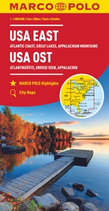
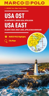
MARCO POLO Kontinentalkarte USA Ost 1:2 Mio.
MAIRDUMONT (Verlag)
978-3-8297-3938-2 (ISBN)
- Titel erscheint in neuer Auflage
- Artikel merken
lt;p>Entdecken Sie mit dieser MARCO POLO Karte das Land mit dem Mythos der unbegrenzten Möglichkeiten . . . Die Karten bestechen durch eine leicht lesbare, neue Kartografie, in der durchgängig landschaftlich schöne Strecken und Orte markiert sind. Schon in der im Kartendeckel befindlichen, ausklappbaren Übersichtskarte sind die schönsten Orte mit Highlightsternen gekennzeichnet und gelben oder grünen Markierungen unterlegt, um unterwegs auch wirklich nichts zu verpassen. Wo alle Orte auf der Karte zu finden sind, ist im Registerheft nachzuschlagen.
lt;p>Marco Polo was the original, trailblazing 'tourist'. Born around 1254 into a wealthy Venetian merchant family, at the age of 17 he embarked on an epic journey to Asia and was one of the first westerners to visit China. When he returned he recorded his extensive travels by publishing a book which introduced Europeans to Central Asia and China, possibly the first 'travel guide' ever published!
Marco Polo's travels have since inspired countless adventurers to set off and see the world. It is reputed that Christopher Columbus set off across the Atlantic with a copy of Marco Polo's original book. It is this pioneering spirit that drives us at Marco Polo to provide the best guides, maps, atlases, and phrasebooks to help you explore the world. We hope our guides and maps will inspire you to set off on your own adventures.
Pocket Guides
Compact, colourful guides packed with Insider Tips
Spiral Guides
Itinerary-based guides in a unique, lay-flat spiral bound format
Travel Handbooks
Visually inspiring, comprehensive guides offering detailed advice and informative infographics
Folded Maps
High quality touring maps with innovative Zoom system
City & Holiday Maps
Compact, laminated maps with a detailed scale and maximum coverage
marcopologuides.com
lt;p>Hauptkarte 1: 2 000 000 mit mehrsprachiger Legende (GB, D, F, NL, I, E, CZ, PL)/ Übersichtskarte mit Highlightsternen zum Ausklappen/ Verwaltungskarte/ Entfernungstabelle/ Index: Marco Polo Highlights/ Nationalparkkarte Everglades/ Nationalparkkarte Great Smoky Mountains/ Citypläne: - Atlanta - Boston - Chicago - Detroit - Fort Lauderdale - Miami - Miami Beach - New York - Philadelphia - Savannah - Washington D.C. Reise- und Verkehrsinformationen/ Ortsregister mit Nation, Bundesstaat und Suchfeldangabe/ Ausgewählte Sehenswürdigkeiten, Landschafts- und Gewässernamen mit Suchfeldangabe/
| Erscheint lt. Verlag | 8.5.2019 |
|---|---|
| Reihe/Serie | MARCO POLO Kontinental /Länderkarten |
| Verlagsort | Ostfildern |
| Sprache | deutsch |
| Maße | 130 x 250 mm |
| Gewicht | 244 g |
| Themenwelt | Reisen ► Karten / Stadtpläne / Atlanten ► Nord- / Mittelamerika |
| Schlagworte | Big Apple • Boston • Chicago • East Coast • Everglades • Fastfood • Florida • Freiheitsstatue • Große Seen • Highways • Motorcity • New York • Ostküste (USA), Karte • Ostküste (USA), Karte; Autokarte/Straßenkarte • Ostküste (USA); Karten • USA, America, Great Lakes, Appalachian Mountains, Atlantic Coast, Florida, The States, travel maps, • Washington D.C. • Weißes Haus |
| ISBN-10 | 3-8297-3938-9 / 3829739389 |
| ISBN-13 | 978-3-8297-3938-2 / 9783829739382 |
| Zustand | Neuware |
| Informationen gemäß Produktsicherheitsverordnung (GPSR) | |
| Haben Sie eine Frage zum Produkt? |
aus dem Bereich


