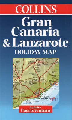
Gran Canaria, Lanzarote and Fuerteventura
1999
|
New edition
Collins (Verlag)
978-0-00-448926-1 (ISBN)
Collins (Verlag)
978-0-00-448926-1 (ISBN)
- Titel ist leider vergriffen;
keine Neuauflage - Artikel merken
Single sided map, previously published as the Bartholomew Lanzarote,Gran Canaria and Fuerteventura Holiday Map. Now rebranded Collins. SCALE 1 : 170 000 1 cm to 1.7 kms 1 inch to 2.7 miles
EDITION
Single sided map, previously published as the Bartholomew Lanzarote, Gran Canaria and Fuerteventura Holiday Map. Now rebranded Collins.
MAIN FEATURES
Road map of the Canary Islands of Gran Canaria, Lanzarote and Fuerteventura with tourist information. Indexes to places of interest and hotels.
INCLUDES
Town plans of Las Palmas and Playa del Inglés. Holiday factfile on back cover.
AREA OF COVERAGE
Islands of Gran Canaria, Lanzarote and Fuerteventura.
WHO THE PRODUCT IS AIMED AT
Tourist and package holiday maker.
OTHER PRODUCTS IN THE SERIES
Tenerife
Ibiza
Menorca
Mallorca
Costa del Sol and Gibraltar
Algarve
Plus a range of maps covering most popular holiday destinations
| Erscheint lt. Verlag | 1.2.1999 |
|---|---|
| Reihe/Serie | Holiday Map |
| Verlagsort | London |
| Sprache | englisch |
| Maße | 868 x 520 mm |
| Gewicht | 61 g |
| Themenwelt | Reisen ► Karten / Stadtpläne / Atlanten ► Europa |
| Reisen ► Karten / Stadtpläne / Atlanten ► Afrika | |
| Reisen ► Karten / Stadtpläne / Atlanten ► Welt / Arktis / Antarktis | |
| ISBN-10 | 0-00-448926-8 / 0004489268 |
| ISBN-13 | 978-0-00-448926-1 / 9780004489261 |
| Zustand | Neuware |
| Haben Sie eine Frage zum Produkt? |
Mehr entdecken
aus dem Bereich
aus dem Bereich
Straßen- und Freizeitkarte 1:250.000
Karte (gefalzt) (2023)
Freytag-Berndt und ARTARIA (Verlag)
12,90 €
Karte (gefalzt) (2023)
Freytag-Berndt und ARTARIA (Verlag)
12,90 €
Östersund
Karte (gefalzt) (2023)
Freytag-Berndt und ARTARIA (Verlag)
12,90 €


