


Britain
2002
|
3rd Revised edition
Automobile Association (Verlag)
978-0-7495-3249-9 (ISBN)
Automobile Association (Verlag)
978-0-7495-3249-9 (ISBN)
- Titel erscheint in neuer Auflage
- Artikel merken
Zu diesem Artikel existiert eine Nachauflage
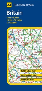
This map of Britain shows motorways, dual carriagways, and local roads and includes information on service areas, road numbers, tunnels and passes, ferry routes, railways, and national and administrative boundaries. It also indicates places of interest and national parks.
| Erscheint lt. Verlag | 2.1.2002 |
|---|---|
| Reihe/Serie | AA Road Maps ; No. 10 |
| Verlagsort | Basingstoke |
| Sprache | englisch |
| Maße | 110 x 246 mm |
| Gewicht | 95 g |
| Themenwelt | Reisen ► Karten / Stadtpläne / Atlanten ► Europa |
| ISBN-10 | 0-7495-3249-1 / 0749532491 |
| ISBN-13 | 978-0-7495-3249-9 / 9780749532499 |
| Zustand | Neuware |
| Informationen gemäß Produktsicherheitsverordnung (GPSR) | |
| Haben Sie eine Frage zum Produkt? |
Mehr entdecken
aus dem Bereich


aus dem Bereich
Straßen- und Freizeitkarte 1:250.000
Karte (gefalzt) (2023)
Freytag-Berndt und ARTARIA (Verlag)
12,90 €
Narvik
Karte (gefalzt) (2023)
Freytag-Berndt und ARTARIA (Verlag)
12,90 €
Karte (gefalzt) (2023)
Freytag-Berndt und ARTARIA (Verlag)
12,90 €