


Pembrokeshire Coast Path Map Booklet
Cicerone Press (Verlag)
978-1-85284-896-5 (ISBN)
- Titel ist leider vergriffen;
keine Neuauflage - Artikel merken
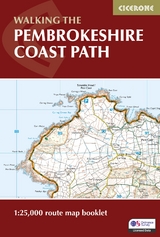
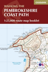
All the mapping you need to complete the 180 mile/290km long-distance Pembrokeshire Coast Path National Trail from Amroth to St Dogmaels in Wales. It typically takes two weeks to walk the whole trail, but it lends itself equally to day walking. It is suitable for walkers at all levels of experience.
This booklet of Ordnance Survey 1:25,000 Explorer maps has been designed for convenient use on the trail. It shows the full and up-to-date line of the Pembrokeshire Coast Path, along with the relevant extract from the OS Explorer map legend. It can be used when walking the trail in either direction. It is conveniently sized for slipping into a jacket pocket or top of a rucksack.
This booklet is included with the Cicerone guidebook to the Pembrokeshire Coast Path National Trail.
Renowned for its spectacular scenery, flowers, and wildlife, this route through the Pembrokeshire Coast National Park takes in some of Britain's finest coastal walking, in an area steeped in history.
Dennis and Jan Kelsall published their first Cicerone title in 1995 and have since written around 35 guides to some of Britain's most popular walking areas: they have also become regular contributors to various outdoor magazines. Their enjoyment of the countryside extends far beyond a love of fresh air, open spaces and scenery: over the years Dennis and Jan have developed wider interests in the environment, geology and wildlife, as well as an enthusiasm for local history, which so often provides clues to interpreting the landscape.
Pembrokeshire Coast Path
Map key
Contents and using this guide
Stage 1 Amroth to Skrinkle Haven
Stage 2 Skrinkle Haven to Broad Haven
Stage 3 Broad Haven to West Angle
Stage 4 West Angle to Pembroke
Stage 5 Pembroke to Sandy Haven
Stage 6 Sandy Haven to Westdale Bay
Stage 7 Westdale Bay to Little Haven
Stage 8 Little Haven to Solva
Stage 9 Solva to Whitesands Bay
Stage 10 Whitesands Bay to Aber Draw
Stage 11 Aber Draw to Pwll Deri
Stage 12 Pwll Deri to Goodwick Sands
Stage 13 Goodwick Sands to Newport Parog
Stage 14 Newport Parog to St Dogmaels
Extract from OS Explorer map legend
| Erscheint lt. Verlag | 15.9.2023 |
|---|---|
| Reihe/Serie | Cicerone guidebooks |
| Co-Autor | Dennis Kelsall, Jan Kelsall |
| Verlagsort | Kendal |
| Sprache | englisch |
| Maße | 116 x 172 mm |
| Gewicht | 100 g |
| Themenwelt | Sachbuch/Ratgeber ► Sport |
| Reisen ► Karten / Stadtpläne / Atlanten ► Europa | |
| ISBN-10 | 1-85284-896-0 / 1852848960 |
| ISBN-13 | 978-1-85284-896-5 / 9781852848965 |
| Zustand | Neuware |
| Informationen gemäß Produktsicherheitsverordnung (GPSR) | |
| Haben Sie eine Frage zum Produkt? |
aus dem Bereich


