


The Wild Atlantic Way Route Atlas: Ireland's Journey West
Seiten
2015
Xploreit Maps (Verlag)
978-0-9552655-6-3 (ISBN)
Xploreit Maps (Verlag)
978-0-9552655-6-3 (ISBN)
- Titel erscheint in neuer Auflage
- Artikel merken
Zu diesem Artikel existiert eine Nachauflage
The Wild Atlantic Way is the new touring route along Ireland's west coast. This foldout atlas has detailed maps with scenic roads highlighted and must-see destinations clearly marked. Equally suitable for short excursions or for navigating the entire route, it is an indispensable tool for those exploring this wild and rugged seascape.
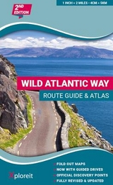
The Wild Atlantic Way is the world's longest defined coastal route. It includes Ireland's most southerly point, Mizen Head in Cork, and its most northerly one, Malin Head in Donegal. All along the way you will find a myriad of spectacular discovery points with incredible scenic views. This atlas splits up the route into 30 Fold-Out maps which are detailed yet easy to read. The coastal roads are classified so that you are instantly aware of any narrow sections and you can also see where the really scenic stretches are located. Each section is drivable in one day or less and there are useful distance charts for towns and villages to help you plan your journey. All of the official Discovery Points are clearly shown including the 15 iconic Signature Points. Over 40 different categories of visitor information are shown to help you locate numerous hidden gems and well-known attractions. A variety of coastal and forest walks in the vicinity of the route are detailed.Main Features: 30 Fold-Out road maps showing the route and road types - Route Planning maps - Gazetteer of Discovery Points with GPS coordinates and brief descriptions - Distance Charts for towns and villages - Scenic sections highlighted - Ferry departure points - Wide range of other visitor attractions and points of interest shown - Map legend in English, German and French - Map Scale 2 miles to 1 inch.
1:126,720.
| Erscheint lt. Verlag | 17.7.2015 |
|---|---|
| Verlagsort | Ennis |
| Sprache | englisch |
| Maße | 164 x 270 mm |
| Themenwelt | Reisen ► Karten / Stadtpläne / Atlanten ► Europa |
| ISBN-10 | 0-9552655-6-8 / 0955265568 |
| ISBN-13 | 978-0-9552655-6-3 / 9780955265563 |
| Zustand | Neuware |
| Informationen gemäß Produktsicherheitsverordnung (GPSR) | |
| Haben Sie eine Frage zum Produkt? |
Mehr entdecken
aus dem Bereich


aus dem Bereich
Buch | Spiralbindung (2024)
Freytag-Berndt und ARTARIA (Verlag)
29,90 €