


Hadrian's Wall Path Map Booklet
Cicerone Press (Verlag)
978-1-85284-893-4 (ISBN)
- Titel ist leider vergriffen;
keine Neuauflage - Artikel merken
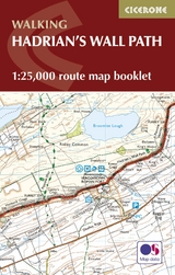
All the mapping you need to walk the 84 mile (135km) Hadrian's Wall Path from Bowness-on-Solway in Cumbria to Wallsend, Newcastle.
This booklet of Ordnance Survey 1:25,000 Explorer maps has been designed for convenient use on the trail. It shows the full and up-to-date line of the Hadrian's Wall Path, along with the relevant extract from the OS Explorer map legend. It can be used when walking the trail west-east or east-west, and includes an extension to the east coast at South Shields. It is conveniently sized for slipping into a jacket pocket or top of a rucksack. This booklet is included with the Cicerone guidebook to Hadrian's Wall Path National Trail.
In 1980 Mark Richards began his three-part guide to the Peak District for Cicerone Press, and in 1987, with Chris Wright, wrote a guide to walking around the former county of Westmorland. He now lives in Cumbria and, after 14 years' dedicated research, has completed his series of Lakeland Fellranger guides covering the entire region. Mark lives close to Hadrian's Wall, enabling him to renew a fascination kindled when he first prepared a guide to walking the Wall in 1991.
Hadrian's Wall Path
Map key
Contents and using this guide
Section 1 Bowness-on-Solway to Burgh-by-Sands
Section 2 Burgh-by-Sands to Carlisle
Section 3 Carlisle to Newtown
Section 4 Newtown to Birdoswald
Section 5 Birdoswald to Steel Rigg
Section 6 Steel Rigg to Brocolitia
Section 7 Brocolitia to Portgate
Section 8 Portgate to Heddon-on-the-Wall
Section 9 Heddon-on-the-Wall to Newcastle Quayside
Section 10 Newcastle Quayside to South Shields
Extract from OS Explorer map legend
| Erscheint lt. Verlag | 7.12.2021 |
|---|---|
| Reihe/Serie | Cicerone guidebooks |
| Co-Autor | Mark Richards |
| Verlagsort | Kendal |
| Sprache | englisch |
| Maße | 106 x 166 mm |
| Gewicht | 70 g |
| Themenwelt | Sachbuch/Ratgeber ► Sport |
| Reisen ► Karten / Stadtpläne / Atlanten ► Europa | |
| Reisen ► Sport- / Aktivreisen | |
| ISBN-10 | 1-85284-893-6 / 1852848936 |
| ISBN-13 | 978-1-85284-893-4 / 9781852848934 |
| Zustand | Neuware |
| Haben Sie eine Frage zum Produkt? |


