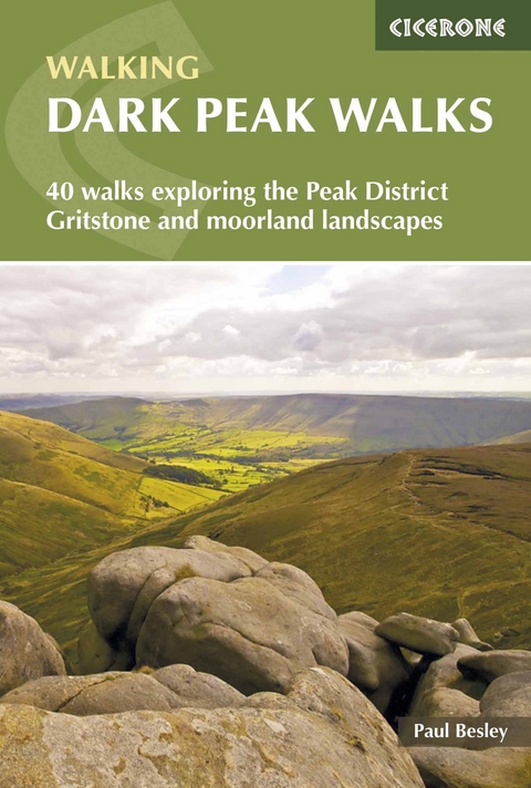
Dark Peak Walks
Cicerone Press (Verlag)
978-1-85284-519-3 (ISBN)
A guidebook to 35 day walks exploring the valleys and landmarks of the Dark Park area of the Peak District National Park, and 5 longer routes exploring the region’s more wild and remote gritstone edges and open moorland. With a variety of distances, terrain and strenuousness there are routes for all levels of ability.
The day walks are circular and range from 7 to 22km (4–14 miles), and can be enjoyed in between 3 and 7 hours. The longer routes – 3 linear and 2 circular – are between 25 and 45km (15–28 miles) in length, and take from 8 to 13 hours to complete.
1:50,000 OS maps included for each day walk, and 1:100,000 maps for longer routes
GPX files available to download
Refreshment and public transport options are given where relevant
Information given on local geology and wildlife
Easy access from Hathersage, Castleton, Glossop, Sheffield
Paul Besley is a volunteer Ranger for the Peak District National Park and a member of Woodhead Mountain Rescue, an informative walking guide and writer. He first went walking in the Dark Peak when he was 14 years old and a love of the high moors and gritstone edges was born. Over the following years he has explored the area, walking its moorlands, investigating hidden cloughs, expanding his knowledge and experience of this landscape.
Map keys
Overview map
Introduction
Geology
Plants and wildlife
History
The future
Local services and transport
The walks
Responsible walking
Maps and navigation
Using this guide
Eastern Dark Peak
Walk 1 Chatsworth to Birchen Edge
Walk 2 Longshaw Estate and the gritstone edges
Walk 3 Fox House to Big Moor
Walk 4 Fox House to Stanedge Pole
Walk 5 Grindleford to Higger Tor
Central Dark Peak
Walk 6 Hathersage to Stanage Edge
Walk 7 Wyming Brook to Stanage Edge
Walk 8 Bamford Moor
Walk 9 Win Hill to Hope Cross
Walk 10 Kings Tree to Shepherds Meeting Stones
Walk 11 Westend and Bleaklow Stones
Walk 12 Derwent Edge
Walk 13 Alport Castles and the Woodlands Valley
Walk 14 Margery Hill to Back Tor
Walk 15 Low Bradfield and Dale Dyke
Walk 16 Langsett to Howden Edge
Walk 17 Langsett to Pike Lowe
Walk 18 Torside to Bleaklow Head
Walk 19 Wildboar Clough to Lawrence Edge
Walk 20 Old Glossop to Bleaklow Head
Walk 21 Kinder Scout Northern Edge
Walk 22 Kinder Scout Western Edge
Walk 23 Kinder Scout
Walk 24 Kinder Scout Southern Edge
Walk 25 The Great Ridge
Northern Dark Peak
Walk 26 Dunford Bridge to Ramsden Clough
Walk 27 Crowden Horseshoe
Walk 28 Crowden to Chew Valley
Walk 29 Marsden to Black Hill
Walk 30 Alphin Pike to Birchen Clough
Walk 31 Binn Green to Great Dove Stone Rock
Walk 32 Cotton Famine Road
Western Dark Peak
Walk 33 Goyt Valley to Shining Tor
Walk 34 Derbyshire Bridge to Shutlingsloe
Walk 35 The Roaches
Long day walks
Walk 36 Marsden to Edale
Walk 37 Langsett to Edale
Walk 38 Gritstone edges
Walk 39 Edale Horseshoe
Walk 40 Kinder Scout skyline
Appendix A Route summary table
Appendix B Useful information
Appendix C Aircraft crash site locations
| Erscheint lt. Verlag | 17.8.2021 |
|---|---|
| Reihe/Serie | Cicerone guidebooks |
| Zusatzinfo | 89 colour photos, 41 maps |
| Verlagsort | Kendal |
| Sprache | englisch |
| Maße | 116 x 172 mm |
| Gewicht | 250 g |
| Themenwelt | Sachbuch/Ratgeber ► Sport |
| Reiseführer ► Europa ► Großbritannien | |
| Reisen ► Sport- / Aktivreisen ► Europa | |
| ISBN-10 | 1-85284-519-8 / 1852845198 |
| ISBN-13 | 978-1-85284-519-3 / 9781852845193 |
| Zustand | Neuware |
| Haben Sie eine Frage zum Produkt? |
aus dem Bereich


