


Philip's Road Map France and Belgium
Seiten
2015
Philip's (Verlag)
978-1-84907-385-1 (ISBN)
Philip's (Verlag)
978-1-84907-385-1 (ISBN)
- Titel erscheint in neuer Auflage
- Artikel merken
Zu diesem Artikel existiert eine Nachauflage
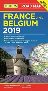
A fully revised new edition of Philip's ultra-clear, double-sided road map covering the whole of France and Belgium, with a comprehensive index and seven town plans.
PHILIP'S BEST-SELLING RANGE OF BRITISH AND EUROPEAN MAPS
'The clearest and most detailed maps of Europe' David Williams MBE, CEO, Gem Motoring Assist.
- The perfect planning maps for your trip to France and Belgium
- Scale 16 miles to 1 inch = 1:100,000
- Double-sided folded map with full index of place names
- Super-clear mapping
- All major routes shown
- Town plans: Paris - plus Bordeaux, Boulogne, Brussels, Calais, Lyon, Marseilles
- Scenic routes
- AutoRoute junctions, restricted junctions and toll motorways and pre-pay motorways
- Mountain passes and gradients
- Tourist attractions
| Erscheint lt. Verlag | 2.7.2015 |
|---|---|
| Verlagsort | London |
| Sprache | englisch |
| Maße | 135 x 246 mm |
| Gewicht | 105 g |
| Themenwelt | Reisen ► Karten / Stadtpläne / Atlanten ► Europa |
| Reiseführer ► Europa ► Belgien | |
| Reiseführer ► Europa ► Frankreich | |
| ISBN-10 | 1-84907-385-6 / 1849073856 |
| ISBN-13 | 978-1-84907-385-1 / 9781849073851 |
| Zustand | Neuware |
| Haben Sie eine Frage zum Produkt? |
Mehr entdecken
aus dem Bereich


aus dem Bereich