Walking in the Wye Valley
Cicerone Press (Verlag)
978-1-85284-724-1 (ISBN)
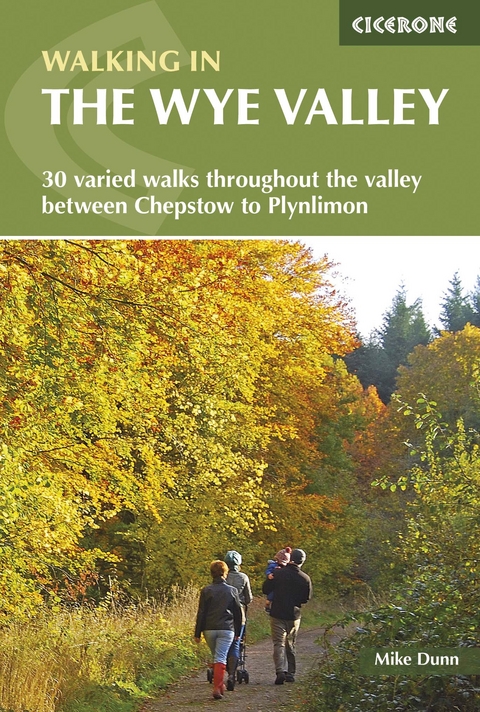
A guidebook to 30 walks exploring the Wye Valley, spanning both sides of the Welsh-English border. From Plynlimon and the river’s source to the Wye Valley National Landscape, the varied routes range from short, easy strolls to strenuous upland outings.
The walks can be enjoyed in 2–6 hours and range from 5 to 5km (3–10 miles) in length.
1:50,000 OS maps, reproduced at 1:40,000, included for each walk
Sized to easily fit in a jacket pocket
Notes on public transport and parking
Information on the region’s rich geology, plantlife and wildlife
Handy route summary table and overview information make it easy to choose an appropriate route
Mike Dunn was born and bred in the English Midlands but has lived in Penarth in the Vale of Glamorgan for over 25 years. He has worked for the Welsh Assembly Government, specialising in environmental and conservation issues, and has also written widely on landscape, walking, pubs and real ale. Mike's favourite locations for walking are the Welsh borders, the Hebridean Islands and the Lake District.
Map key
Overview map
Introduction
Geology and landscape
Plants and wildlife
Man's impact on the landscape
Getting to and around the Wye Valley
Where to Stay
When to go and what to take
Maps and waymarking
Using this guide
1 The Lower Wye: Chepstow to Ross on Wye
Walk 1 The Lancaut Peninsula
Walk 2 The Wyndcliff
Walk 3 The Devil's Pulpit from the East
Walk 4 Tintern and the Angidy Valley
Walk 5 Trellech and Beacon Hill
Walk 6 The Kymin
Walk 7 King Arthur's Cave and the Seven Sisters
Walk 8 Coppet Hill and Goodrich
2 The Middle Wye: Ross-on-Wye to Hay-on-Wye
Walk 9 Sellack and Hoarwithy
Walk 10 Capler Camp from Fownhope
Walk 11 Haugh Wood
Walk 12 Aconbury Hill
Walk 13 Breinton Springs
Walk 14 Black and White Weobley
Walk 15 Arthur's Stone and Merbach Common
Walk 16 Kilvert's Clyro
3 Upper Middle Wye: Hay-on-Wye to Newbridge-on-Wye
Walk 17 Talgarth and Llanelieu
Walk 18 The Begwns
Walk 19 Brechfa Pool
Walk 20 Llewellyn's Cave and Aberedw Rocks
Walk 21 Llandeilo Hill and Twm Tobacco's Grave
Walk 22 Builth and Banc-y-Celyn
Walk 23 Cors y Llyn
Walk 24 Shaky Bridge
4 The Upper Wye: Newbridge-on-Wye to Plynlimon
Walk 25 Above the Elan Valley reservoirs
Walk 26 Drygarn Fawr
Walk 27 Gilfach Farm
Walk 28 The Monks' Trod
Walk 29 Llangurig to Llanidloes
Walk 30 Plynlimon and the source of the Wye
Appendix A Route Summary Table
Appendix B Useful contacts
| Erscheint lt. Verlag | 1.6.2022 |
|---|---|
| Reihe/Serie | Cicerone guidebooks |
| Verlagsort | Kendal |
| Sprache | englisch |
| Maße | 116 x 172 mm |
| Gewicht | 210 g |
| Themenwelt | Sachbuch/Ratgeber ► Sport |
| Reisen ► Sport- / Aktivreisen ► Europa | |
| ISBN-10 | 1-85284-724-7 / 1852847247 |
| ISBN-13 | 978-1-85284-724-1 / 9781852847241 |
| Zustand | Neuware |
| Haben Sie eine Frage zum Produkt? |
aus dem Bereich
