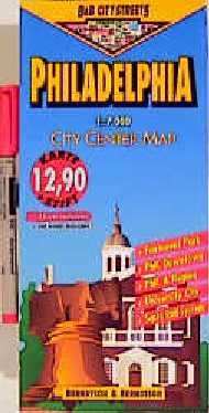
Philadelphia
1:7000. Nebenkarten: University City 1:12000. Fairmount Park 1:15000. Philadelphia & Region 1:125000. Public Transportation
1997
Berndtson & Berndtson (Hersteller)
978-3-929811-43-8 (ISBN)
Berndtson & Berndtson (Hersteller)
978-3-929811-43-8 (ISBN)
- Titel ist leider vergriffen;
keine Neuauflage - Artikel merken
This easy-to-fold laminated city map of Philadelphia features large-scale street plans, a map of the greater city area and a public transport map. There are grid references for points of interest, theatres and hotels. Routes can be marked and erased on the easy-to-clean surface.
| Reihe/Serie | B & B City Streets |
|---|---|
| Verlagsort | Furstenfeldbru |
| Sprache | englisch |
| Gewicht | 80 g |
| Themenwelt | Reisen ► Karten / Stadtpläne / Atlanten ► Nord- / Mittelamerika |
| ISBN-10 | 3-929811-43-X / 392981143X |
| ISBN-13 | 978-3-929811-43-8 / 9783929811438 |
| Zustand | Neuware |
| Informationen gemäß Produktsicherheitsverordnung (GPSR) | |
| Haben Sie eine Frage zum Produkt? |