Great Maps
Dorling Kindersley (Verlag)
978-1-4654-2463-1 (ISBN)
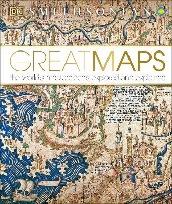
From examples of medieval Mappa Mundi and the first atlas to Google Earth and maps of the moon, this captivating maps book is a must-have for all history and geography enthusiasts and explorers!
Embark on a visual tour of the world’s finest maps! This fascinating world atlas book:
• Analyses each map visually, with the help of pull-outs and graphic close-up details
• Traces the history of maps chronologically, providing a fascinating overview of cartography through the ages
• Tells the story behind each map — why it was created, who it was for, and how it was achieved
• Profiles key cartographers, explorers and artists
• Draws together navigation, propaganda, power, art and politics through the world's greatest maps
Maps are much more than just geographical data. They are an accurate reflection of the culture and context of different time frames in history. This remarkable geography book puts cartography on the map! It tells the stories behind great maps through stunning pull-out details and reveals how they have helped people make sense of the world.
Embark on a global adventure of a lifetime with this world map book and see our planet like never before! On this mind-blowing journey, you’ll encounter maps that show the way to heaven, depict lands with no sunshine, and even the world ocean floor.
With incredible secret stories from British historian Jerry Brotton and insight into how mapmakers have expressed their world views, Great Maps is a welcome addition to any armchair cartographer’s bookshelf.
DK was founded in London in 1974 and is now the world's leading illustrated reference publisher and part of Penguin Random House, formed on July 1, 2013. DK publishes highly visual, photographic nonfiction for adults and children. DK produces content for consumers in over 87 countries and in 62 languages, with offices in Delhi, London, Melbourne, Munich, New York, and Toronto. DK's aim is to inform, enrich, and entertain readers of all ages, and everything DK publishes, whether print or digital, embodies the unique DK design approach. DK brings unrivalled clarity to a wide range of topics with a unique combination of words and pictures, put together to spectacular effect. We have a reputation for innovation in design for both print and digital products. Our adult range spans travel, including the award-winning DK Eyewitness Travel Guides, history, science, nature, sport, gardening, cookery, and parenting. DK’s extensive children’s list showcases a fantastic store of information for children, toddlers, and babies. DK covers everything from animals and the human body, to homework help and craft activities, together with an impressive list of licensing titles, including the bestselling LEGO® books. DK acts as the parent company for Alpha Books, publisher of the Idiot's Guides series and Prima Games, video gaming publishers, as well as the award-winning travel publisher, Rough Guides.
| Erscheint lt. Verlag | 18.8.2014 |
|---|---|
| Reihe/Serie | DK History Changers |
| Verlagsort | New York |
| Sprache | englisch |
| Maße | 260 x 308 mm |
| Gewicht | 1616 g |
| Themenwelt | Reisen ► Karten / Stadtpläne / Atlanten ► Welt / Arktis / Antarktis |
| Geisteswissenschaften ► Geschichte ► Allgemeine Geschichte | |
| Naturwissenschaften ► Geowissenschaften ► Geografie / Kartografie | |
| ISBN-10 | 1-4654-2463-6 / 1465424636 |
| ISBN-13 | 978-1-4654-2463-1 / 9781465424631 |
| Zustand | Neuware |
| Haben Sie eine Frage zum Produkt? |
aus dem Bereich


