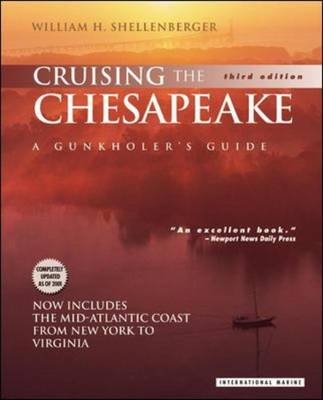
Cruising the Chesapeake: A Gunkholer’s Guide
International Marine Publishing Co (Verlag)
978-0-07-136371-6 (ISBN)
- Titel ist leider vergriffen;
keine Neuauflage - Artikel merken
More than 200 miles long and 40 miles wide at its broadest, the Chesapeake Bay is the largest inland tidal body of water on the Atlantic seaboard. Sheltered from the Atlantic swells and resplendent with natural wonders, historical attractions, and more than a few cosmopolitan delights, it is also a cruiser's paradise. A major part of the Chesapeake's charm derives from the numerous creeks, coves and inlets - gunkholes, in Chesapeake parlance - dotting its more than 3,000-mile shoreline. The difficulty of finding and entering many of these secluded hideaways discourages less adventuresome cruisers - or at least it used to. Since 1990, "Cruising the Chesapeake" has been the guide of choice for sailors seeking to avoid the beaten path.No other guide to the region offers such complete, detailed coverage of virtually every point of interest on the Bay - from the secluded east fork of Langford Creek to the bustling hearts of Baltimore, Washington, and Norfolk. Nor does any other guide feature such an engaging, heartfelt evocation of the Bay, its shores, history, wildlife, and people.
Drawing upon his 30 years of experience cruising the Bay, as well as the latest navigational information, Bill Shellenberger tells you how to approach each spot covered, where to anchor, and what sort of dockage facilities and provisions are available there. He also fills you in on what has happened there in the past and what there is to see and do there now.This third edition of the classic guide has been expanded to include an extensive section on the harbors of the mid-Atlantic coast from New York to Virginia, as well as the Delaware Bay and the Delaware River from Cape May to Trenton. It also now includes: a cruise planner with suggested itineraries for cruises of various length, supported by navigation charts; aerial photos of key anchorages and tricky passages; a catalog of GPS coordinates; and, updated information on piloting and shore side facilities.A comprehensive cruise planner and navigation guide and a vivid celebration of one of North America's natural treasures, "Cruising the Chesapeake" is a book no Chesapeake boater will want to be without. Gunkhole is a shallow cove of channel nearly unnavigable because of mud, rocks, or vegetation.
Gunkholer is a species of boater that is inexorably drawn to gunkholes in search of seclusion, adventure, wildlife - or just by an ungovernable urge to see what's around the next bend. Gunkholers are readily identified by their lack of concern at running aground and their well-thumbed copies of "Cruising the Chesapeake: A Gunkholer's Guide".'A copy [of this guide] should be in the hands of the fleet captains of every yacht club as well as in the library of every cruising yachtsman...It should be consulted each step of a cruise in much the same manner one checks his charts before getting underway' - "Eastern-Southeast Boating". 'Shellenberger has perfected the art of gunkholing...An excellent book for both those who enjoy weekend cruises and those who merely want to know more about Chesapeake Bay' - "Daily Press" (Newport News, VA). 'With more than 3,000 miles of shoreline, the Chesapeake Bay offers a treasury of cruising spots. Shellenberger's book provides the key to unlock it' - "The Virginian-Pilot". 'An 'insider's' look at the hundreds of places cruisers and weekend boaters love to hole up in...It is also a loving portrait of the bay, its history, its people, its wildlife, and its environment' - "The Mariner".
'A truly monumental guide' - "Sunday Capital" (Annapolis, MD).
William H. Shellenberger has cruised the Chesapeake for more than 25 years, and has made the study of its numerous gunkholes his lifes work.
AcknowledgmentsPrefaceHow to Use This BookThe RegionsAnchoragesRatingsSketch MapsCaveat YachtsmanIntroductionA Bit about the ChesapeakeNavigating the BayAtlantic Coastal Region & Approaches to the ChesapeakeHazards to NavigationGeneral HazardsAn Abbreviated Chesapeake RomanceShellfishingFishingSuggested CruisesNorthern Chesapeake BayCentral Chesapeake BaySouthern Chesapeake BayHarbors of the Chesapeake BayRegion 1: Head of Bay to Pooles IslandEastern ShoreElk RiverSassafras RiverHowell Point to Fairlee CreekWestern ShoreNortheast RiverSusquehanna RiverSpesutie Island to Pooles IslandRegion 2: Pooles Island to Bay BridgesEastern ShoreTolchester Beach, Swan Creek, & Rock HallChester RiverWestern ShoreGunpowder RiverSeneca Creek, Middle River, & Back RiverPatapsco RiverMagothy RiverRegion 3: Bay Bridges to Little Choptank RiverEastern ShoreKent Island (Bay Side)Eastern BayPoplar Island Narrows & Poplar HarborChoptank RiverLittle Choptank RiverWestern ShoreWhitehall BaySevern RiverFishing CreekSouth RiverRhode River & West RiverHerring Bay to Plum PointRegion 4: Little Choptank River to Potomac RiverEastern ShoreHonga RiverFishing BayNanticoke RiverWicomico RiverDeal IslandManokin RiverBig Annemessex RiverLittle Annemessex RiverSmith IslandTangier IslandWestern ShorePlum Point to Patuxent RiverPatuxent RiverSt. Jerome CreekRegion 5: Potomac RiverMouth of Potomac to Port Tobacco RiverLower Potomac RiverSt. Marys RiverCoan RiverYeocomico RiverHerring CreekLower Machodoc CreekNomini Bay & CreekCurrioman BayBreton & St. Clements BaysWicomico RiverPopes CreekMattox & Monroe CreeksUpper Machodoc CreekPort Tobacco River to WashingtonPort Tobacco RiverNanjemoy CreekPotomac CreekAquia & Quantico CreeksUpper Potomac RiverWashington, D.C.Region 6: Potomac River to Wolf Trap LightEastern ShorePocomoke SoundChesconessex Creek to Hungars CreekWestern ShoreLittle Wicomico RiverGreat Wicomico RiverMill Creek to Fleets BayRappahannock RiverPiankatank RiverRegion 7: Wolf Trap Light to Cape HenryEastern ShoreCape Charles Harbor, Kings Creek, & Cherrystone InletKiptopeke BeachCape Charles ChannelWestern ShoreHorn HarborMobjack BayYork RiverBack Creek to Salt PondsHampton RoadsElizabeth River (Norfolk & Portsmouth)James RiverUpper James River to RichmondHampton Roads to Chesapeake Bay BridgesCape HenryThe Atlantic Coast & the Delaware Bay & RiverRegion 8: City Island to Sandy HookCity Island to New York Harbor Upper BayGravesend Bay to Jamaica BayWestern Lower BayRegion 9: Sandy Hook to Cape MayRegion 10: Delaware Bay & RiverDelaware BayDelaware RiverRegion 11: Delmarva PeninsulaWachapreague Inlet to Cape CharlesChesapeake Bay EntranceAppendices1. VHF-FM Channels2. U.S. Coast Guard Marine Information & Coastal Weather Broadcasts3. Useful Waypoints4. Partial Listing of Charter Services on the Chesapeake5. Dockside Sewage Pumpout Facilities6. BibliographyIndex
| Erscheint lt. Verlag | 16.6.2001 |
|---|---|
| Zusatzinfo | 220 b&w illustrations, 32 colour illustrations, charts |
| Verlagsort | Rockport, ME |
| Sprache | englisch |
| Maße | 196 x 241 mm |
| Gewicht | 1028 g |
| Themenwelt | Sachbuch/Ratgeber ► Sport ► Segeln / Tauchen / Wassersport |
| Reiseführer ► Nord- / Mittelamerika ► USA | |
| ISBN-10 | 0-07-136371-8 / 0071363718 |
| ISBN-13 | 978-0-07-136371-6 / 9780071363716 |
| Zustand | Neuware |
| Haben Sie eine Frage zum Produkt? |
aus dem Bereich


