


East Anglia Road Map
Seiten
2015
|
30th Revised edition
Geographers' A-Z Map Co Ltd (Verlag)
978-1-78257-025-7 (ISBN)
Geographers' A-Z Map Co Ltd (Verlag)
978-1-78257-025-7 (ISBN)
- Titel erscheint in neuer Auflage
- Artikel merken
Zu diesem Artikel existiert eine Nachauflage
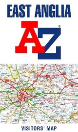
This A-Z map of East Anglia is a full colour, single sided, fold-out road map published at a clear 2 kms to 1 cm scale (3.156 miles to 1 inch).
This map of East Anglia is a full colour, single sided, foldout road map covering an area extending to:
•Grantham
•Boston
•King's Lynn
•Hunstanton
•Cromer
•Great Yarmouth
•Lowestoft
•Aldeburgh
•Felixstowe
•Clacton-on-Sea
•Southend-on-Sea
•Central London
•Slough
•Dunstable
•Bedford
•Stamford
This East Anglia map is shown at a clear 2 kms to 1 cm scale (3.156 miles to 1 inch) and includes the following features:
•Motorways open with full junction detail, motorways under construction and proposed, service areas, primary routes and destinations, A & B roads, selected minor roads, tolls, mileages and county boundaries.
•Selected safety camera locations with their maximum speed limits and fuel stations.
•Selected places of interest, tourist information centres and golf courses.
The index section includes a list of cities, towns, villages, hamlets and locations and is printed to the left of the map.
Britain’s leading street map publisher providing cartographic services, digital data products and paper mapping publications (including Street Atlases, Visitors Guides, Great Britain Road Atlases and The Adventure Atlas).
| Erscheint lt. Verlag | 5.11.2018 |
|---|---|
| Reihe/Serie | A-Z Road Map |
| Sprache | englisch |
| Maße | 153 x 238 mm |
| Gewicht | 114 g |
| Themenwelt | Reisen ► Karten / Stadtpläne / Atlanten ► Europa |
| ISBN-10 | 1-78257-025-X / 178257025X |
| ISBN-13 | 978-1-78257-025-7 / 9781782570257 |
| Zustand | Neuware |
| Haben Sie eine Frage zum Produkt? |
Mehr entdecken
aus dem Bereich


aus dem Bereich
Straßen- und Freizeitkarte 1:250.000
Karte (gefalzt) (2023)
Freytag-Berndt und ARTARIA (Verlag)
12,90 €
Karte (gefalzt) (2023)
Freytag-Berndt und ARTARIA (Verlag)
12,90 €
Östersund
Karte (gefalzt) (2023)
Freytag-Berndt und ARTARIA (Verlag)
12,90 €