Imray Chart A233
Imray, Laurie, Norie & Wilson Ltd (Verlag)
978-1-84623-589-4 (ISBN)
- Titel ist leider vergriffen;
keine Neuauflage - Artikel merken
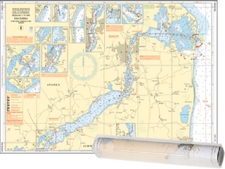
A232 Tortola to Anegada Plans included: Road Harbour & Approaches (Tortola) (1:20,000) Virgin Gorda Yacht Harbour (Virgin Gorda) (1:20,000) South Sound (Virgin Gorda) (1:20,000) Gorda Sound (Virgin Gorda) (1:25,000) Great Camanoe to Scrub Island(1:20,000) Fat Hogs Bay & Maya Cove (Tortola) (1:20,000) For this 2013 edition, the plan of Gorda Sound (Virgin Gorda) has been reschemed - the new version has been drawn at a larger-scale of 1:25,000 to show passages more clearly, and to show various marina developments; the plan of Road Harbour & Approaches has been divided into two plans - one of Road Harbour, and one of Fat Hogs Bay & Maya Cove; and the latest known depths have been applied throughout. PLEASE NOTE There are no sailing directions on this double-sided chart.
Imray Laurie Norie & Wilson Ltd was formed in 1904 when three private chart publishing firms amalgamated. Each of these London companies had a long history going back to the mid-18th century. James Imray and Son published an extensive list of charts and pilot books. RH Laurie and Sons was associated with charts published for the East India Company. Norie and Wilson, founded by JW Norie, whose Nautical Tables are still supplied to navigators across the world, produced charts and books on navigation and sold nautical instruments.Until 1939 we were based in the City of London, where long serving cartographers produced charts from copper plate engravings which were supplied to mariners throughout the World. For over a century Blueback Charts were the first choice of many shipping companies. Now based in St Ives in Cambridgeshire, Imray charts are produced digitally for printed and electronic editions by our drawing office team. Our catalogue of yachting charts is regarded by the sailing community as the most comprehensive available. Our paper charts are complemented by a growing list of electronic publications and high quality pilot books by leading authors.
| Erscheint lt. Verlag | 1.12.2013 |
|---|---|
| Verlagsort | Huntingdon |
| Sprache | englisch |
| Maße | 210 x 295 mm |
| Themenwelt | Sachbuch/Ratgeber ► Sport ► Segeln / Tauchen / Wassersport |
| Reisen ► Karten / Stadtpläne / Atlanten ► Nord- / Mittelamerika | |
| Technik ► Fahrzeugbau / Schiffbau | |
| ISBN-10 | 1-84623-589-8 / 1846235898 |
| ISBN-13 | 978-1-84623-589-4 / 9781846235894 |
| Zustand | Neuware |
| Haben Sie eine Frage zum Produkt? |
aus dem Bereich