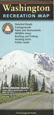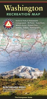
Washington Recreation Map
Seiten
2016
|
2016th Revised ed.
Benchmark Maps (Verlag)
978-0-7834-9908-6 (ISBN)
Benchmark Maps (Verlag)
978-0-7834-9908-6 (ISBN)
- Titel erscheint in neuer Auflage
- Artikel merken
Zu diesem Artikel existiert eine Nachauflage
The Washington Recreation Map is a folded map version of the Recreation Guide pages within Benchmark's Washington Road & Recreation Atlas. The map side features public lands, extensive highway detail, point-to-point mileages, recreation attractions, campgrounds, parks & wildlife areas, boating & fishing access points, and hunting units (GMU). The reverse side features statewide categorized POI listings with helpful descriptions, current contact information, and map grid references.
In 1995, three respected mapping firms collaborated on a vision they shared for a new line of state road atlases. The result was Benchmark Maps: a partnership that would apply the unique talents of each company to produce atlases with an entirely new kind of look and presentation. These new atlases would combine strikingly beautiful Landscape Maps(TM) with data collection of unequaled accuracy and detail. Since our beginning, well over a million Benchmark maps and atlases have been purchased by discriminating map users from all over the world. It's not unusual for us to hear from people who have purchased a copy of every one of our atlases.
| Erscheint lt. Verlag | 1.1.2016 |
|---|---|
| Zusatzinfo | 1 Illustrations, unspecified |
| Sprache | englisch |
| Maße | 102 x 229 mm |
| Themenwelt | Reisen ► Karten / Stadtpläne / Atlanten |
| ISBN-10 | 0-7834-9908-6 / 0783499086 |
| ISBN-13 | 978-0-7834-9908-6 / 9780783499086 |
| Zustand | Neuware |
| Haben Sie eine Frage zum Produkt? |
Mehr entdecken
aus dem Bereich
aus dem Bereich
Karte/Kartografie (2024)
BVA BikeMedia (Verlag)
15,95 €
Karte (gefalzt) (2023)
Freytag-Berndt und ARTARIA (Verlag)
12,90 €
Wander-, Rad- und Freizeitkarte, Maßstab 1:25.000, 4. Auflage
Karte (gefalzt) (2022)
Pietruska (Verlag)
9,90 €


