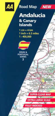
Andalucia and Canary Isles
2001
Automobile Association (Verlag)
978-0-7495-2893-5 (ISBN)
Automobile Association (Verlag)
978-0-7495-2893-5 (ISBN)
- Keine Verlagsinformationen verfügbar
- Artikel merken
Zu diesem Artikel existiert eine Nachauflage
Detailed and up-to-date with very clear modern mapping, this map of Andalucia and the Canary Islands features full details of motorways, dual carriageways, local roads and those still under construction, and also includes information on toll gates, service areas, and administrative boundaries.
From one of Spain's leading cartographic publisher's, Anaya, this detailed up-to-date map features 6.3 miles to 1 inch scale (1:400,000/1cm = 4 km) mappins and extensive place-name index. It also provides all the information you'll need on motorways, dual and single carriageways, local roads and those that are still under construction. Plus there are details on toll gates and fees, service areas, road numbers, as well as tunnels and passes. National parks and places of interest are also indicated, making this map perfect suitable for touring and sight-seeing, as well as for travelling on business.
From one of Spain's leading cartographic publisher's, Anaya, this detailed up-to-date map features 6.3 miles to 1 inch scale (1:400,000/1cm = 4 km) mappins and extensive place-name index. It also provides all the information you'll need on motorways, dual and single carriageways, local roads and those that are still under construction. Plus there are details on toll gates and fees, service areas, road numbers, as well as tunnels and passes. National parks and places of interest are also indicated, making this map perfect suitable for touring and sight-seeing, as well as for travelling on business.
| Erscheint lt. Verlag | 31.3.2001 |
|---|---|
| Reihe/Serie | AA Road Map Spain & Portugal S. |
| Verlagsort | Basingstoke |
| Sprache | englisch |
| Maße | 110 x 246 mm |
| Gewicht | 255 g |
| Themenwelt | Reisen ► Karten / Stadtpläne / Atlanten ► Europa |
| Reisen ► Karten / Stadtpläne / Atlanten ► Welt / Arktis / Antarktis | |
| ISBN-10 | 0-7495-2893-1 / 0749528931 |
| ISBN-13 | 978-0-7495-2893-5 / 9780749528935 |
| Zustand | Neuware |
| Informationen gemäß Produktsicherheitsverordnung (GPSR) | |
| Haben Sie eine Frage zum Produkt? |
Mehr entdecken
aus dem Bereich
aus dem Bereich
Straßen- und Freizeitkarte 1:250.000
Karte (gefalzt) (2023)
Freytag-Berndt und ARTARIA (Verlag)
12,90 €
Baskenland, Navarra, Aragon, Andorra, Katalonien
Karte/Kartografie (2023)
MAIRDUMONT (Verlag)
11,95 €
Karte (gefalzt) (2024)
Freytag-Berndt und ARTARIA (Verlag)
12,90 €


