


AA Road Atlas Britain
Seiten
2013
|
28
Automobile Association (Verlag)
978-0-7495-7456-7 (ISBN)
Automobile Association (Verlag)
978-0-7495-7456-7 (ISBN)
- Titel erscheint in neuer Auflage
- Artikel merken
Zu diesem Artikel existiert eine Nachauflage
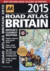
This top-selling road atlas showcases Britain's clearest mapping, at 3.2 miles to 1 inch, from the experts at the AA. Each page has been titled with its geographical location so you can turn to the page you need more easily. Static speed camera locations with speed limits are pinpointed. Wide minor roads, National Trust, English and World Heritage, crematorium locations and other hard-to-find places are also shown. There are 104 city, town and port plans, full-colour county, unitary and administrative area map and a comprehensive 31,500 entry index with airports, top tourist sites and motorway services listed. Plus, scenic routes, tourist sites with satnav friendly postcodes and caravan and camping sites symbolised on the mapping. The paper in this atlas is produced from environmentally sustainable resources.
AA Publishing is the UK's biggest travel publisher and one of the top ten worldwide.
| Erscheint lt. Verlag | 1.7.2013 |
|---|---|
| Zusatzinfo | Scale: 3.2 miles to 1 inch |
| Verlagsort | Basingstoke |
| Sprache | englisch |
| Maße | 220 x 297 mm |
| Themenwelt | Reisen ► Karten / Stadtpläne / Atlanten ► Europa |
| ISBN-10 | 0-7495-7456-9 / 0749574569 |
| ISBN-13 | 978-0-7495-7456-7 / 9780749574567 |
| Zustand | Neuware |
| Haben Sie eine Frage zum Produkt? |
Mehr entdecken
aus dem Bereich


aus dem Bereich
Buch | Spiralbindung (2024)
Freytag-Berndt und ARTARIA (Verlag)
29,90 €