


AA Easy Read Britain
Seiten
2013
|
14
Automobile Association (Verlag)
978-0-7495-7452-9 (ISBN)
Automobile Association (Verlag)
978-0-7495-7452-9 (ISBN)
- Titel erscheint in neuer Auflage
- Artikel merken
Zu diesem Artikel existiert eine Nachauflage
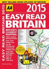
This A4 format atlas provides giant scale mapping, at 2.3 miles to 1 inch, making it very easy to use. Each page has been titled with its geographical location so you can turn to the page you need more easily. Static speed camera locations with speed limits are pinpointed. Wide minor roads (more than and less than 4m wide), National Trust, English and World Heritage sites, crematorium and other hard-to-find places are also shown. There is also a full-colour admin map showing all the latest unitary authority areas and a route-planning map. The paper in this atlas is produced from environmentally sustainable resources.
AA Publishing is the UK's biggest travel publisher and one of the top ten worldwide.
| Erscheint lt. Verlag | 1.7.2013 |
|---|---|
| Zusatzinfo | Scale: 2.3 miles to 1 inch |
| Verlagsort | Basingstoke |
| Sprache | englisch |
| Maße | 215 x 300 mm |
| Themenwelt | Reisen ► Karten / Stadtpläne / Atlanten ► Europa |
| ISBN-10 | 0-7495-7452-6 / 0749574526 |
| ISBN-13 | 978-0-7495-7452-9 / 9780749574529 |
| Zustand | Neuware |
| Haben Sie eine Frage zum Produkt? |
Mehr entdecken
aus dem Bereich


aus dem Bereich
Buch | Spiralbindung (2024)
Freytag-Berndt und ARTARIA (Verlag)
29,90 €