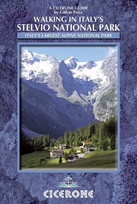
Walking in Italy's Stelvio National Park
Cicerone Press (Verlag)
978-1-85284-690-9 (ISBN)
A guidebook to 38 day walks in Italy’s Stelvio National Park. Exploring the beautiful scenery of the Italian Rhaetian Alps, the walks are suitable for beginner and experienced walkers alike.
Routes range from 5-18km (3-11 miles) and can be enjoyed in 2-7 hours. They are and are perfect for walking late June through October.
Sketch maps included for each walk
Highlights include the Stelvio Pass, Forno glacier and Ortler
Detailed information on planning, accommodation and public transport
Sized to easily fit in a jacket pocket
After a degree in Anthropology and working in adult education, Gillian Price travelled through Asia and trekked the Himalaya. Eventually settling in Venice, she now works as a freelance travel writer. Gillian is steadily exploring all the mountain ranges and flatter parts of Italy, and has produced a series of outstanding guides for Cicerone. She is an active member of the Italian Alpine Club CAI and Mountain Wilderness.
Introduction
Geography
History
Nomenclature
Plants and flowers
Wildlife
Valleys and bases
Getting there
Local transport
Information
When to go
Accommodation
Food and drink
What to take
Maps
Dos and don'ts
Emergencies
Using this guide
Walks
Walk 1 St Gertraud Alm Route
Walk 2 Höchsterhütte Circuit
Walk 3 Fischersee Walk
Walk 4 Rifugio Lago Corvo
Walk 5 Rifugio Dorigoni Tour
Walk 6 Baito Campisolo Route
Walk 7 Cascate di Saent
Walk 8 Ragaiolo Falls and the Venetian Sawmill
Walk 9 Val Cercen
Walk 10 Rifugio Larcher Tour
Walk 11 Monte Vioz
Walk 12 Sentiero dei Tedeschi
Walk 13 Malga Covel and Waterfalls
Walk 14 Forte Barba di Fior Loop
Walk 15 Lago di Pian Palù Circuit
Walk 16 Dosso Tresero
Walk 17 The Forni Sentiero Glaciologico Alto
Walk 18 Valle di Ced&##xe8;c
Walk 19 Rifugio Casati
Walk 20 Val Zebrù and Rifugio V° Alpini
Walk 21 Lago della Manzina
Walk 22 Santa Caterina to Sant'Antonio
Walk 23 Monte delle Scale
Walk 24 Valle Forcola Traverse
Walk 25 Monte Scorluzzo and Filone dei Möt
Walk 26 Goldseeweg
Walk 27 Berglhütte
Walk 28 Trafoi Waterfalls
Walk 29 Tabarettahütte
Walk 30 Hintergrathütte Tour
Walk 31 Düsseldorferhütte and Kanzel Circuit
Walk 32 Madritschjoch and Hintere Schöntaufspitze
Walk 33 The Martelltal Glacier Trail
Walk 34 Zufritt See and Larchboden Loop
Walk 35 Stallwieshof Traverse
Walk 36 Pedertal
Walk 37 Orgelspitze
Walk 38 Soyalm
Appendix A Route summary table
Appendix B Glossary
Appendix C Accommodation
Appendix D Useful contacts
| Erscheint lt. Verlag | 15.6.2013 |
|---|---|
| Reihe/Serie | Cicerone guidebooks |
| Zusatzinfo | 100 colour photos and 40 maps |
| Verlagsort | Kendal |
| Sprache | englisch |
| Maße | 116 x 172 mm |
| Gewicht | 220 g |
| Themenwelt | Sachbuch/Ratgeber ► Sport |
| Reiseführer ► Europa ► Italien | |
| Reisen ► Sport- / Aktivreisen ► Europa | |
| ISBN-10 | 1-85284-690-9 / 1852846909 |
| ISBN-13 | 978-1-85284-690-9 / 9781852846909 |
| Zustand | Neuware |
| Haben Sie eine Frage zum Produkt? |
aus dem Bereich


