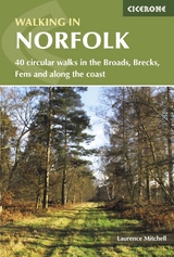
Walking in Norfolk
Cicerone Press (Verlag)
978-1-85284-636-7 (ISBN)
- Titel ist leider vergriffen;
keine Neuauflage - Artikel merken
This book describes 40 easy-to-moderate circular day walks, grouped by area: Northeast coast and the Broads; South Norfolk, the Yare and the Waveney; North Norfolk and coast; Central Norfolk and Breckland and West Norfolk and Fens. Each walk is described step-by-step, illustrated with 1:40K OS map extracts and packed with historical, geological and other information about the landscape the route passes through.
The Fenland region of Norfolk's far west is flat and low-lying, as are the marshes and waterways of the Broads in the east, but between these two extremes there is a great deal of topography going on. The county is far more varied than most outsiders imagine, with several distinct and unique landscapes. As well as Broads and the Fens, it has the sandy Brecks, rolling farmland, ancient woodland, meandering rivers and the gorgeous North Norfolk coast with its beaches, shingle banks, salt marshes and tidal mud flats.
Laurence Mitchell worked as a geography teacher for many years before becoming a travel writer and photographer. He has written guides to Serbia and Kyrgyzstan and is especially interested in off-the-beaten-track locations. When not abroad he likes to explore his own backyard of Norfolk and Suffolk.
Map key
Overview
Introduction
A brief history
Landscapes
Wildlife
National Parks and AONBs
Getting there and back
When to go
What to take
Food and drink
Waymarks and access
Safety
Maps
Using this guide
Longer walks in Norfolk
1 Northeast coast and the Broads
Walk 1 Winterton-on-Sea
Walk 2 Potter Heigham and Hickling Broad
Walk 3 North Walsham
Walk 4 Happisburgh
Walk 5 Horstead and River Bure
2 South Norfolk, the Yare and Waveney
Walk 6 Hardley Flood
Walk 7 Outney Common and Earsham
Walk 8 Rockland St Mary and Claxton
Walk 9 Surlingham
Walk 10 Burgh St Peter and 'The Triangle'
Walk 11 Burgh Castle and Breydon Water
Walk 12 Shotesham
Walk 13 Fritton Common
Walk 14 Harleston and Redenhall
Walk 15 Cringleford and River Yare
Walk 16 New and Old Buckenham
3 North Norfolk and coast
Walk 17 Sheringham and Beeston Regis
Walk 18 Bodham and Baconsthorpe
Walk 19 Itteringham
Walk 20 Aylsham and Blickling
Walk 21 Old Hunstanton, Thornham and Holme-next-the-Sea
Walk 22 Snettisham
Walk 23 Salthouse and Cley-next-the-Sea
Walk 24 Blakeney and Wiveton Downs
Walk 25 Little Walsingham, Houghton St Giles and Great Snoring
Walk 26 Brancaster Staithe and Barrow Common
4 Central Norfolk and Breckland
Walk 27 Thompson Common and Pingo Trail
Walk 28 Swannington and Upgate Common
Walk 29 Hockering
Walk 30 Shipdham
Walk 31 Santon Warren and Thetford Forest
5 West Norfolk and Fens
Walk 32 Harpley and Peddars Way
Walk 33 Tittleshall and Godwick
Walk 34 Helhoughton and West Raynham
Walk 35 Castle Acre
Walk 36 Roydon and Roydon Common
Walk 37 Narborough and Nar Valley
Walk 38 Beachamwell
Walk 39 Hilgay Fen
Walk 40 The Wiggenhalls
Appendix A Route summary table
Appendix B Useful contacts
Appendix C Further reading
Appendix D Long-distance walks in Norfolk
| Zusatzinfo | Over 90 photos and 40 maps |
|---|---|
| Verlagsort | Kendal |
| Sprache | englisch |
| Maße | 116 x 172 mm |
| Themenwelt | Sachbuch/Ratgeber ► Sport |
| Reiseführer ► Europa ► Großbritannien | |
| ISBN-10 | 1-85284-636-4 / 1852846364 |
| ISBN-13 | 978-1-85284-636-7 / 9781852846367 |
| Zustand | Neuware |
| Informationen gemäß Produktsicherheitsverordnung (GPSR) | |
| Haben Sie eine Frage zum Produkt? |
aus dem Bereich


