


Italy South - Michelin Regional Map 564
Map
Seiten
2013
|
2019
Michelin Editions des Voyages (Verlag)
978-2-06-718405-3 (ISBN)
Michelin Editions des Voyages (Verlag)
978-2-06-718405-3 (ISBN)
Zu diesem Artikel existiert eine Nachauflage
With MICHELIN Regional Maps, find more than just your way! In addition to Michelin's clear and accurate mapping, the regional map series includes all the practical information for a trouble free journey, including major town plans as well as tourism information to make the most of your journey. Scales from 1:150,000 to 1:2,400,000
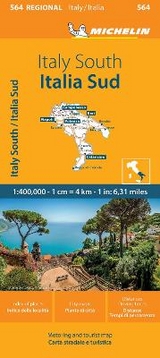
(Edition updated in 2019) MICHELIN Italy South Regional Map scale 1/400,000 will provide you with an extensive coverage of primary, secondary and scenic routes for this region. In addition to Michelin's clear and accurate mapping, this regional map includes all the practical information for a trouble free journey, including major town plans as well as tourism information. Picturesque routes are bordered by a green border. With MICHELIN Regional Maps, find more than just your way!
MICHELIN REGIONAL MAPS include practical information for a trouble free journey and show primary & secondary road networks.
* Administrative boundaries
* Scenic routes and tourist sights
* Place name index
* Time and distance charts
* Plans for a selection of major towns
* Practical information: danger alerts, service stations, picnic areas
In 1889 two brothers, André and Edouard Michelin, took over management of a tyre factory in France. This was the start of a great odyssey to develop human transport solutions, while valuing safety, efficiency and the pleasures of driving on the road. In 1908, André opened the Travel Information Bureau in Paris to help travellers plan their itineraries and then in 1910 the first Michelin road map was published. Today, Michelin has one of the best mapping systems in the world and offers atlases, maps and travel guides for many countries. The iconic Michelin Man, called Bibendum, is one of the most recognised logos of all time — André and Edouard’s vision of how a pile of tyres would look if they made a man.
| Erscheint lt. Verlag | 25.3.2013 |
|---|---|
| Verlagsort | Paris |
| Sprache | englisch |
| Maße | 113 x 250 mm |
| Gewicht | 118 g |
| Themenwelt | Reisen ► Karten / Stadtpläne / Atlanten ► Europa |
| ISBN-10 | 2-06-718405-9 / 2067184059 |
| ISBN-13 | 978-2-06-718405-3 / 9782067184053 |
| Zustand | Neuware |
| Haben Sie eine Frage zum Produkt? |
Mehr entdecken
aus dem Bereich


aus dem Bereich
Straßen- und Freizeitkarte 1:250.000
Karte (gefalzt) (2023)
Freytag-Berndt und ARTARIA (Verlag)
12,90 €
Karte (gefalzt) (2023)
Freytag-Berndt und ARTARIA (Verlag)
12,90 €
Narvik
Karte (gefalzt) (2023)
Freytag-Berndt und ARTARIA (Verlag)
12,90 €